MyTopo
Lessley Mississippi US Topo Map
Couldn't load pickup availability
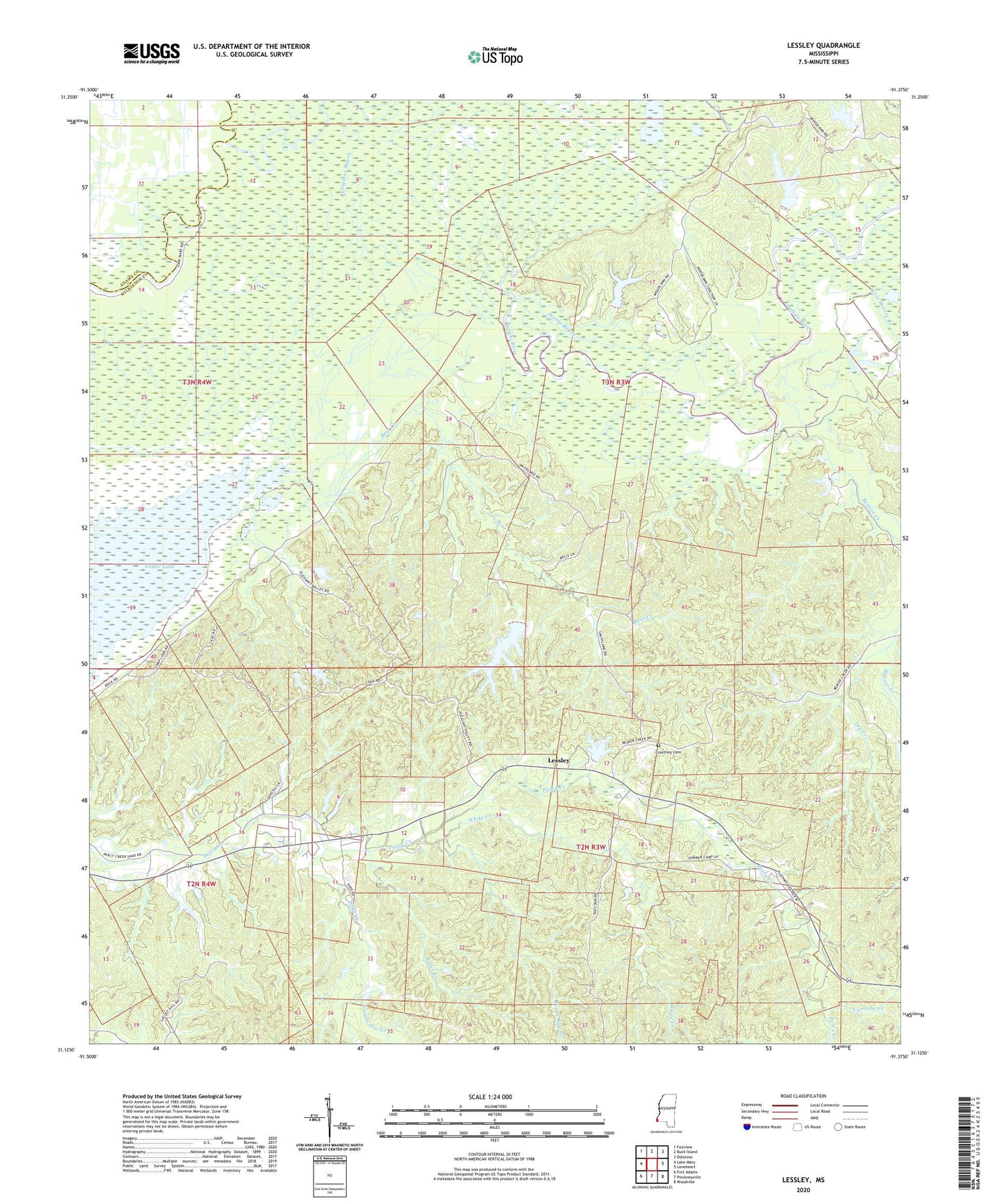
2020 topographic map quadrangle Lessley in the state of Mississippi. Scale: 1:24000. Based on the newly updated USGS 7.5' US Topo map series, this map is in the following counties: Wilkinson, Adams. The map contains contour data, water features, and other items you are used to seeing on USGS maps, but also has updated roads and other features. This is the next generation of topographic maps. Printed on high-quality waterproof paper with UV fade-resistant inks.
Quads adjacent to this one:
West: Lake Mary
Northwest: Fairview
North: Buck Island
Northeast: Doloroso
East: Laneheart
Southeast: Woodville
South: Pinckneyville
Southwest: Fort Adams
Contains the following named places: Alligator Bayou, Alligator Bayou Oil Field, Bear Creek, Beaver Creek, Bullet Branch, Caroline Creek, Courtney Cemetery, Dixons Bayou, Dry Creek, First Zion Church, Hays Creek, Lake Mary Oil Field, Lessley, Little Beaver Creek, Macedonia Church, Macedonia School, North Lessley Oil Field, Oak Hill Church, Peggy Row Branch, Percy Creek School, Pleasant Valley Church, Pleasant Valley Oil Field, Smithland Plantation, West Fork Homochitto River, White Creek, Yamacrow Creek