MyTopo
Gin Branch Mississippi US Topo Map
Couldn't load pickup availability
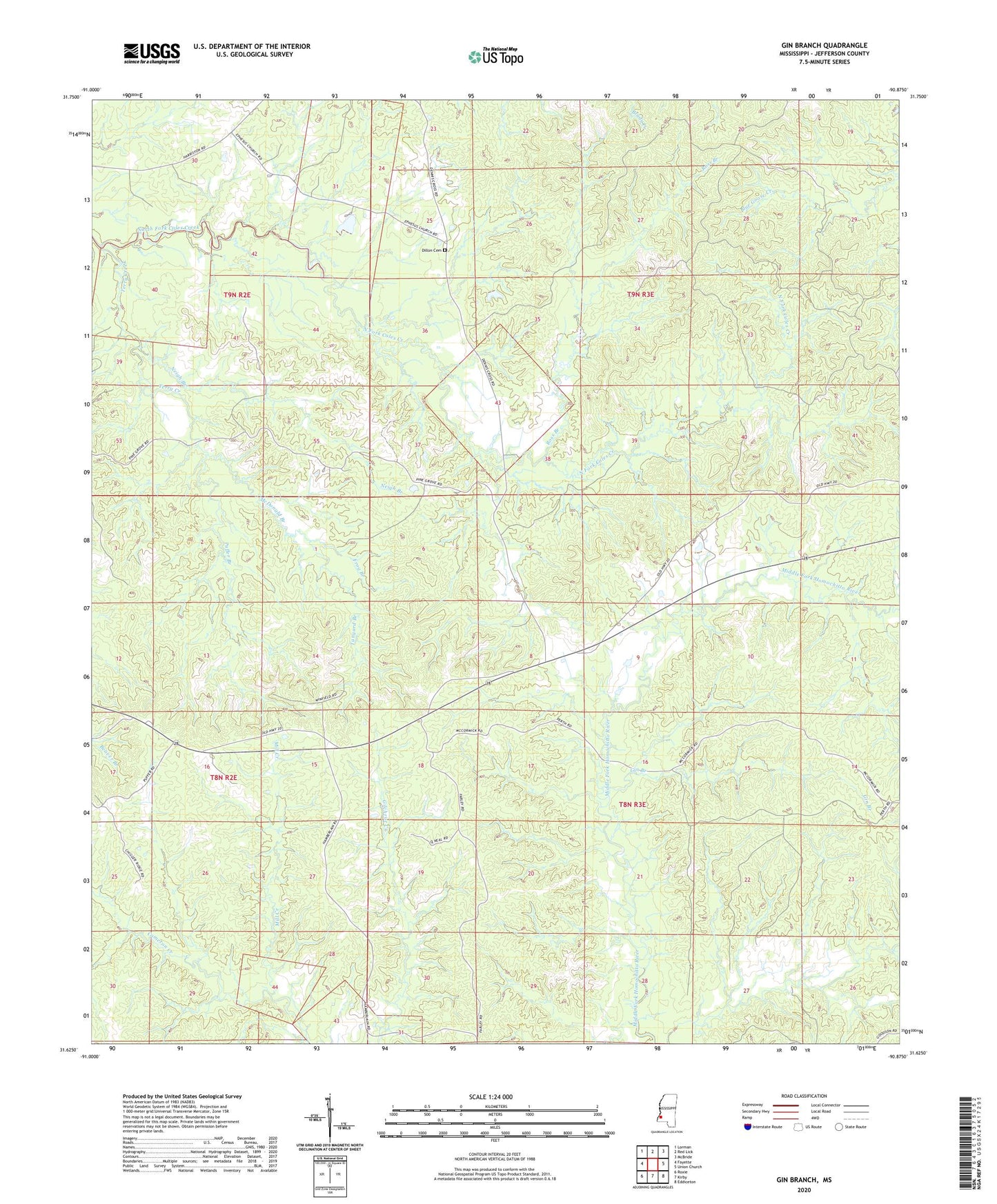
2024 topographic map quadrangle Gin Branch in the state of Mississippi. Scale: 1:24000. Based on the newly updated USGS 7.5' US Topo map series, this map is in the following counties: Jefferson. The map contains contour data, water features, and other items you are used to seeing on USGS maps, but also has updated roads and other features. This is the next generation of topographic maps. Printed on high-quality waterproof paper with UV fade-resistant inks.
Quads adjacent to this one:
West: Fayette
Northwest: Lorman
North: Red Lick
Northeast: McBride
East: Union Church
Southeast: Eddiceton
South: Kirby
Southwest: Roxie
This map covers the same area as the classic USGS quad with code o31090f8.
Contains the following named places: Bethesda Church, Charlie Humphreys Catfish Ponds Dam, Crown Point Church, Dillon Cemetery, Ebenezer Church, Ephesus Church, Frog Branch, Gin Branch, Jefferson, McDonald Branch, Mill Creek, Neigh Branch, Puffer Branch, Ross Branch, Shady Grove Church, Supervisor District 2, Tanyard Branch, Terry Creek