MyTopo
Louin Mississippi US Topo Map
Couldn't load pickup availability
Also explore the Louin Forest Service Topo of this same quad for updated USFS data
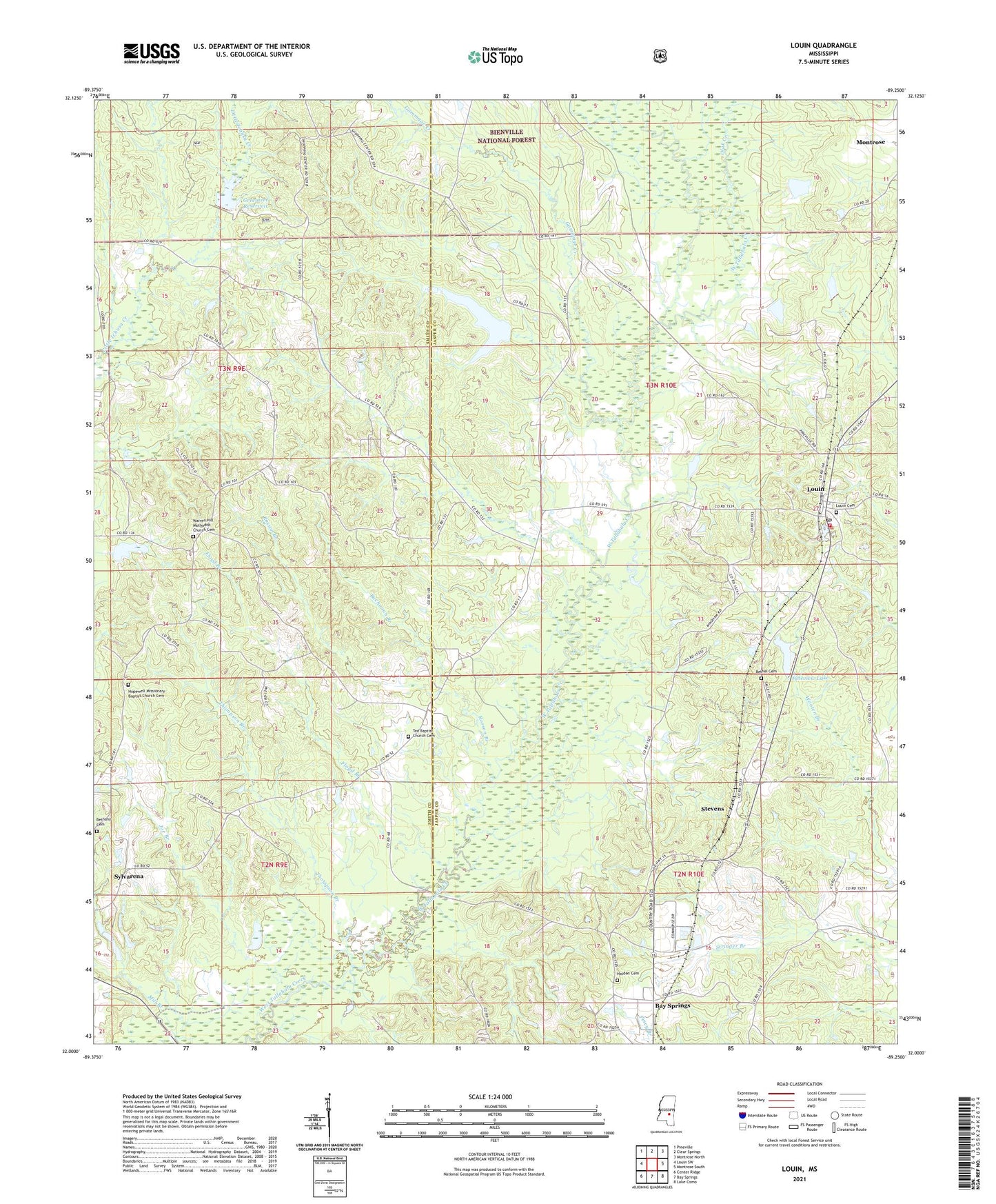
2024 topographic map quadrangle Louin in the state of Mississippi. Scale: 1:24000. Based on the newly updated USGS 7.5' US Topo map series, this map is in the following counties: Jasper, Smith. The map contains contour data, water features, and other items you are used to seeing on USGS maps, but also has updated roads and other features. This is the next generation of topographic maps. Printed on high-quality waterproof paper with UV fade-resistant inks.
Quads adjacent to this one:
West: Louin SW
Northwest: Pineville
North: Clear Springs
Northeast: Montrose North
East: Montrose South
Southeast: Lake Como
South: Bay Springs
Southwest: Center Ridge
This map covers the same area as the classic USGS quad with code o32089a3.
Contains the following named places: Bethany Cemetery, Bethel Cemetery, Bethel Primitive Baptist Church, Boykin, Buchanan Branch, Burns, Dillard School, Floyd Branch, Gammage Creek, Greentree Reservoir, Hamlet, Hill Chapel, Holden Cemetery, Hopewell Church, Jerusalem Baptist Church, Joe Branch, Louin, Louin Baptist Church, Louin Cemetery, Louin Post Office, Louin Volunteer Fire Department, Otak Creek, Phaltie Church, Pineview Lake, Pineview Lake Dam, Rosson Branch, Stevens, Ted, Thompson Branch, Town of Louin, Triumph Church, Ward Lake Dam, Warren Hill Church