MyTopo
Center Ridge Mississippi US Topo Map
Couldn't load pickup availability
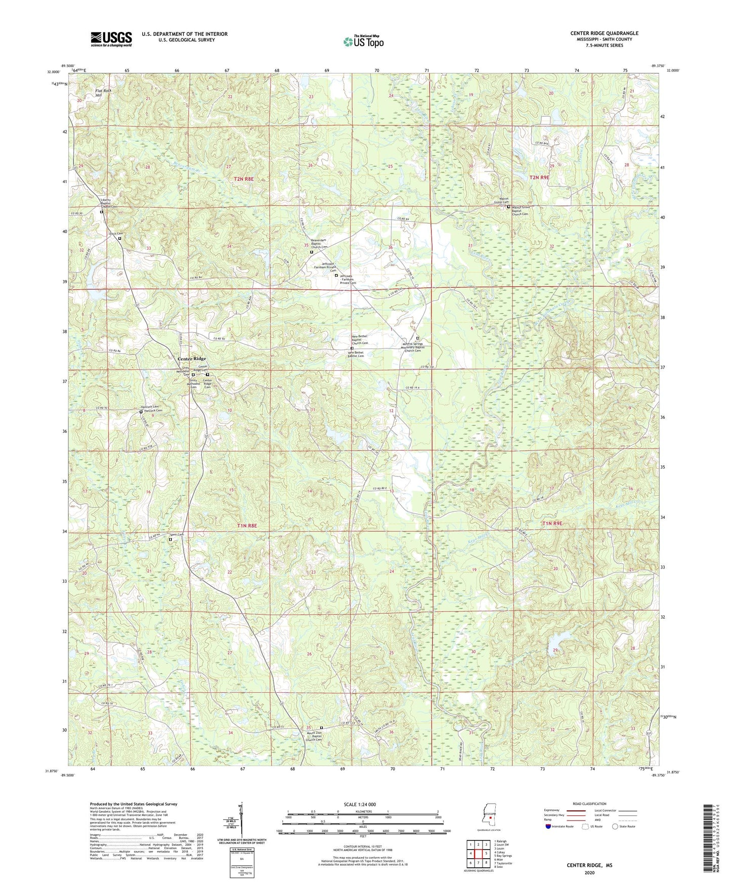
2024 topographic map quadrangle Center Ridge in the state of Mississippi. Scale: 1:24000. Based on the newly updated USGS 7.5' US Topo map series, this map is in the following counties: Smith. The map contains contour data, water features, and other items you are used to seeing on USGS maps, but also has updated roads and other features. This is the next generation of topographic maps. Printed on high-quality waterproof paper with UV fade-resistant inks.
Quads adjacent to this one:
West: Cohay
Northwest: Raleigh
North: Louin SW
Northeast: Louin
East: Bay Springs
Southeast: Soso
South: Taylorsville
Southwest: Mize
This map covers the same area as the classic USGS quad with code o31089h4.
Contains the following named places: Beaverdam Baptist Church Cemetery, Beaverdam Church, Beaverdam Creek, Bezer, Blackwell Lake Dam, Blakeney, Burnett Cemetery, Center Ridge, Center Ridge Church, Center Ridge School, Clarke Lake Dam, Ditch Cemetery, East Tallahalla Creek Oil Field, Hissop, Ichusa Creek, Johnson School, Keys Mill Creek, Liberty Church, Mill Creek, Mineral Springs, Mineral Springs Church, Mineral Springs School, New Bethel Church, Prairie Creek, Saint John Church, Supervisor District 1, Tallahala Creek Oil and Gas Field, Thompson Mill Creek, West Tallahala Creek, Zion Church