MyTopo
Mayersville Mississippi US Topo Map
Couldn't load pickup availability
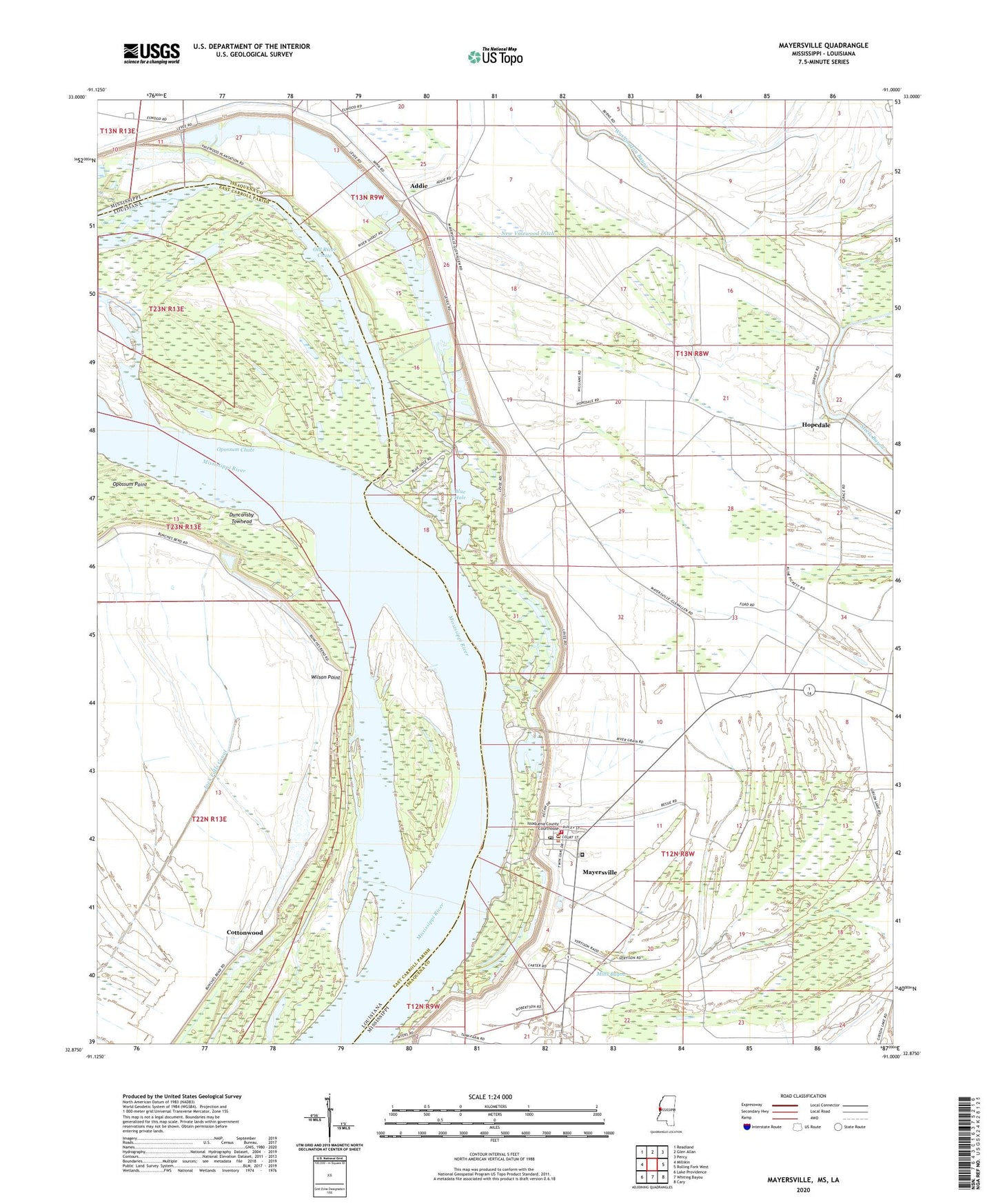
2024 topographic map quadrangle Mayersville in the states of Mississippi, Louisiana. Scale: 1:24000. Based on the newly updated USGS 7.5' US Topo map series, this map is in the following counties: Issaquena, East Carroll. The map contains contour data, water features, and other items you are used to seeing on USGS maps, but also has updated roads and other features. This is the next generation of topographic maps. Printed on high-quality waterproof paper with UV fade-resistant inks.
Quads adjacent to this one:
West: Millikin
Northwest: Readland
North: Glen Allan
Northeast: Percy
East: Rolling Fork West
Southeast: Cary
South: Whiting Bayou
Southwest: Lake Providence
This map covers the same area as the classic USGS quad with code o32091h1.
Contains the following named places: Addie, Ashland, Blue Hole, Browns Landing, Cottonwood, Cottonwood Landing, Duncansby Landing, Duncansby Towhead, Heigle Field Airport, Hopedale, Island Number Ninetythree, Issaquena County Correctional Facility, Issaquena County Courthouse, Issaquena County Fire Department, Issaquena County Sheriff's Office, Issaquena School, Lakeside Ferry, Mayersville, Mayersville Post Office, Millers Landing, Mills Bayou, Morning Star Church, New Bethel Church, New Valewood Ditch, Old River Chute, Opossum Chute, Rose Hill Church, Skipwith Landing, Supervisor District 3, Town of Mayersville, Valewood Landing, Washington Bayou, Wilderness Plantation, Wilson Point, Wilson Point Lake, Wilson Point Landing, ZIP Code: 39113