MyTopo
Glen Allan Mississippi US Topo Map
Couldn't load pickup availability
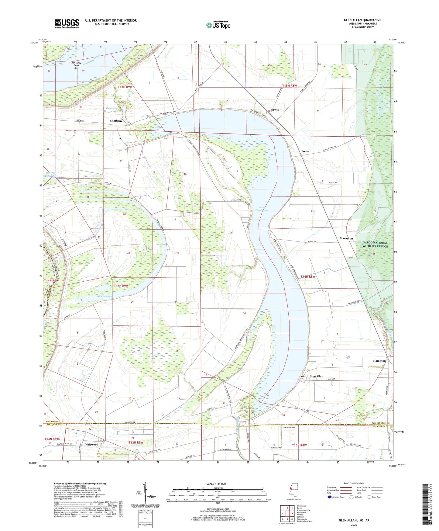
2024 topographic map quadrangle Glen Allan in the states of Mississippi, Arkansas. Scale: 1:24000. Based on the newly updated USGS 7.5' US Topo map series, this map is in the following counties: Washington, Issaquena, Chicot. The map contains contour data, water features, and other items you are used to seeing on USGS maps, but also has updated roads and other features. This is the next generation of topographic maps. Printed on high-quality waterproof paper with UV fade-resistant inks.
Quads adjacent to this one:
West: Readland
Northwest: Eminence
North: Avon
Northeast: Swan Lake NW
East: Percy
Southeast: Rolling Fork West
South: Mayersville
Southwest: Millikin
This map covers the same area as the classic USGS quad with code o33091a1.
Contains the following named places: Alhambra, Allan Chapel, Byrne City, Byrne Lake, Carolina Chute, Chatham, Chatham Community Post Office, Damascus Church, Daniels Chapel, Eastern Star Church, Erwin, Evening Star Church, Foote, Glen Allan, Glen Allan Attendance Center, Glen Allan Census Designated Place, Glen Allan Post Office, Guiding Star Church, Hampton, Kentucky Bend Revetment, Lake Britton, Lake Jackson, Lake Washington, Lake Washington Airport, Leota, Lewis Airport, Linsey, Magnolia Church, Marathon, Metcalfe Cemetery, Minorca Nut Lake, Moore Elementary School, Mount Holly Church, Pleasant Star Church, Princeton, Princeton Landing, Rising Sun Church, Saint Johns Church, Saint Pauls Church, Saint Peters Church, Shiloh Church, Strangers Home Church, Swan Lake Slough, Valewood, ZIP Codes: 38704, 38731, 38744