MyTopo
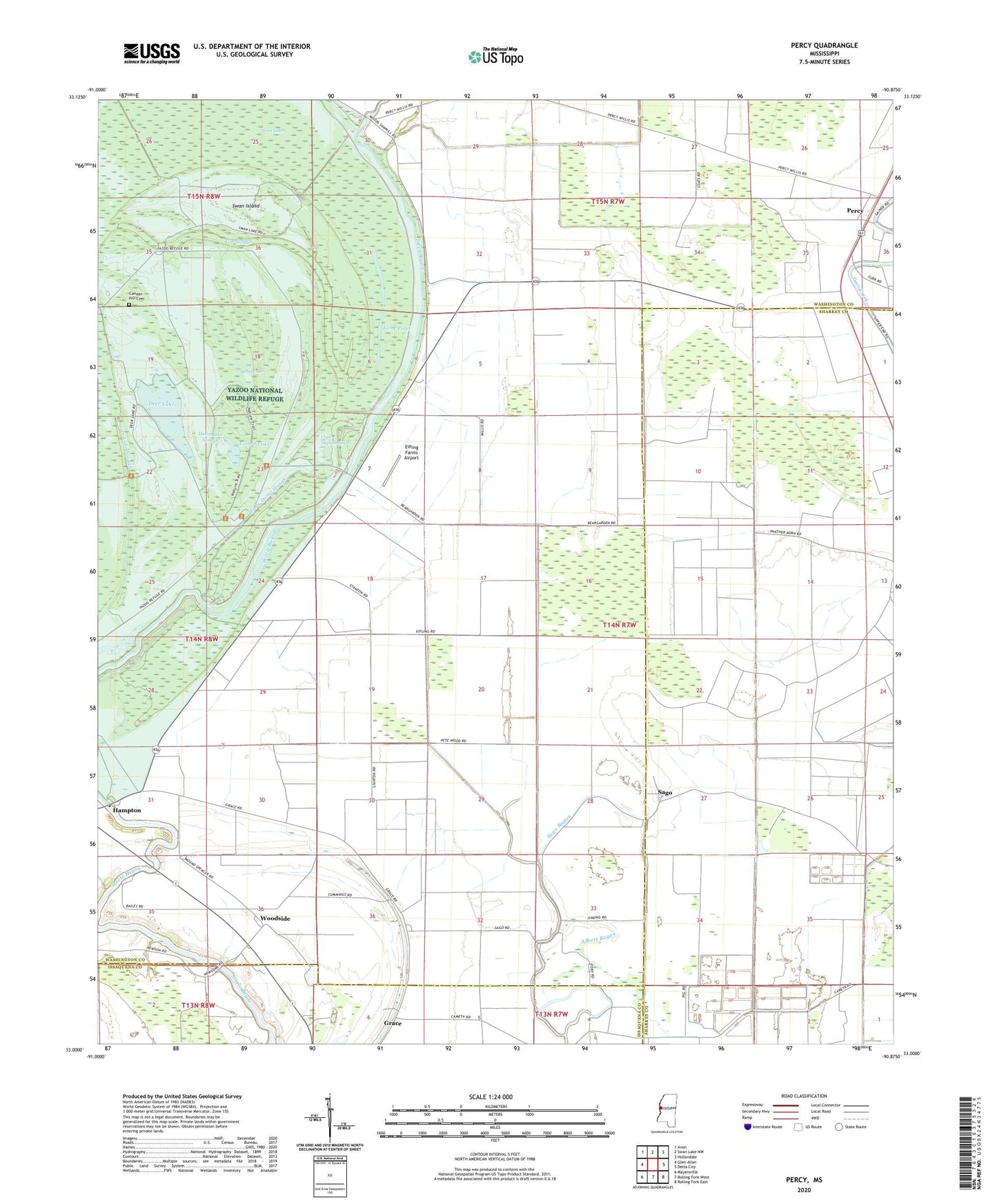
Percy Mississippi US Topo Map
Couldn't load pickup availability
2024 topographic map quadrangle Percy in the state of Mississippi. Scale: 1:24000. Based on the newly updated USGS 7.5' US Topo map series, this map is in the following counties: Washington, Sharkey, Issaquena. The map contains contour data, water features, and other items you are used to seeing on USGS maps, but also has updated roads and other features. This is the next generation of topographic maps. Printed on high-quality waterproof paper with UV fade-resistant inks.
Quads adjacent to this one:
West: Glen Allan
Northwest: Avon
North: Swan Lake NW
Northeast: Hollandale
East: Delta City
Southeast: Rolling Fork East
South: Rolling Fork West
Southwest: Mayersville
This map covers the same area as the classic USGS quad with code o33090a8.
Contains the following named places: Albert Bayou, Bear Garden, Big Lake, Black Bayou, Canaan Hill Cemetery, Canyon Hill Church, Cope Impoundment, Deer Lake, Deer Lake Slough, Eifling Farms Airport, Gin Slough, Goodwill Church, Hoots Dump Slough, Lizard Lake, Long Pond, Mount Aria Church, Mount Marah Church, Mount Zion Church, Percy, Pleasant Hill Church, Sago, Sago Bayou, Shady Grove Church, Spencer, Straight Lake, Swan Island, Tanglewood Plantation, Tonnar Airport, Woodside, Yazoo National Wildlife Refuge, Zion Traveler Church