MyTopo
Union Church Mississippi US Topo Map
Couldn't load pickup availability
Also explore the Union Church Forest Service Topo of this same quad for updated USFS data
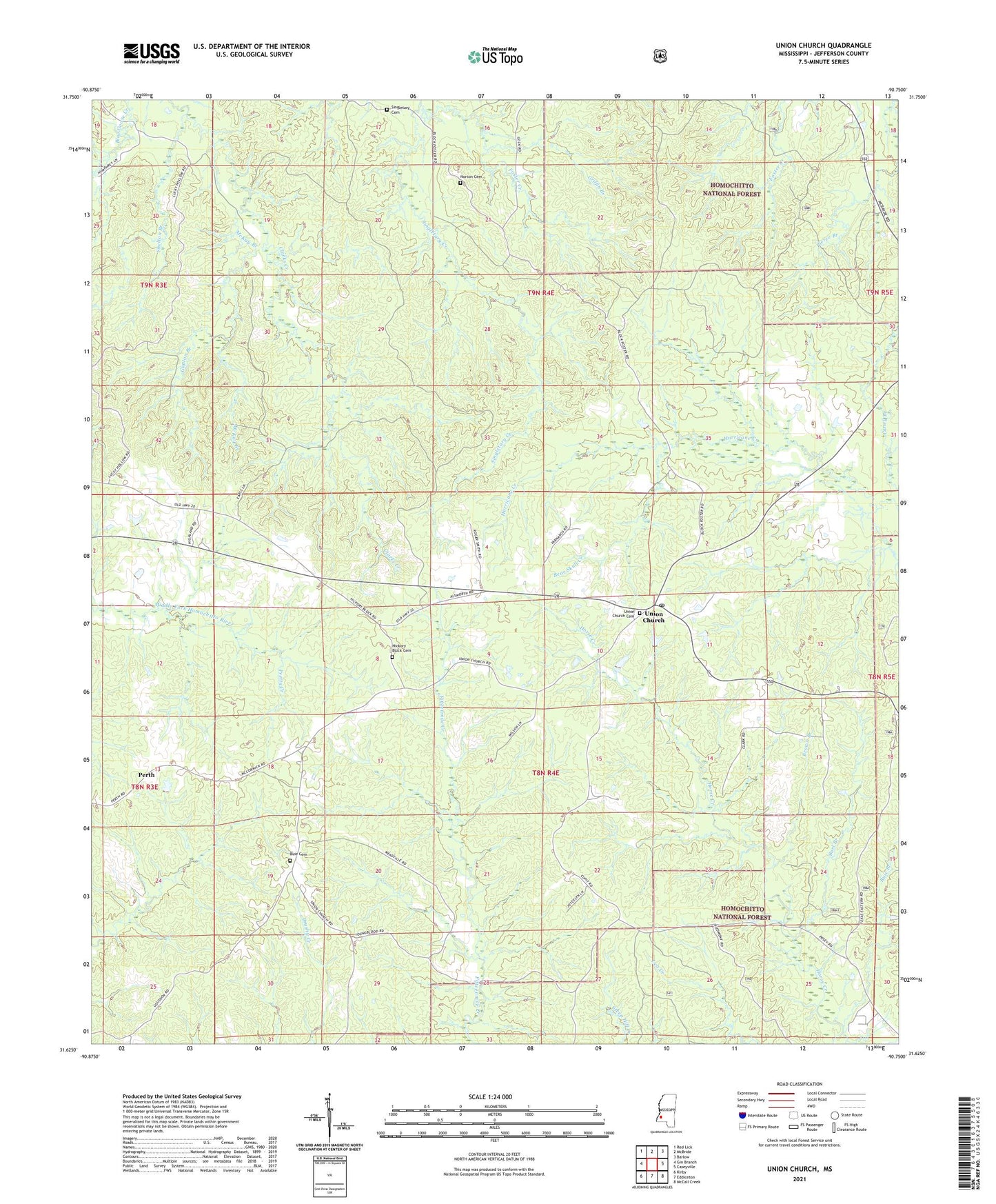
2024 topographic map quadrangle Union Church in the state of Mississippi. Scale: 1:24000. Based on the newly updated USGS 7.5' US Topo map series, this map is in the following counties: Jefferson. The map contains contour data, water features, and other items you are used to seeing on USGS maps, but also has updated roads and other features. This is the next generation of topographic maps. Printed on high-quality waterproof paper with UV fade-resistant inks.
Quads adjacent to this one:
West: Gin Branch
Northwest: Red Lick
North: McBride
Northeast: Barlow
East: Caseyville
Southeast: McCall Creek
South: Eddiceton
Southwest: Kirby
This map covers the same area as the classic USGS quad with code o31090f7.
Contains the following named places: Bear Skull Creek, Bell Hill Church, Brown Branch, Buie Branch, Buie Cemetery, Burl Branch, Caney Branch, Foster Creek, Griffin Branch, Gupton Branch, Hickory Block Cemetery, Hickory Block Church, Knight School, Leedo, McKay Branch, Mount Moriah Church, Nebo Church, Norton Cemetery, Perth, Piedmont Church, Saint Regis Paper Company Dam, Shelton Branch, Singletary Cemetery, Supervisor District 1, Union Church, Union Church Cemetery, Union Church Post Office, Zion Hill Academy, ZIP Code: 39668