MyTopo
McNeill Mississippi US Topo Map
Couldn't load pickup availability
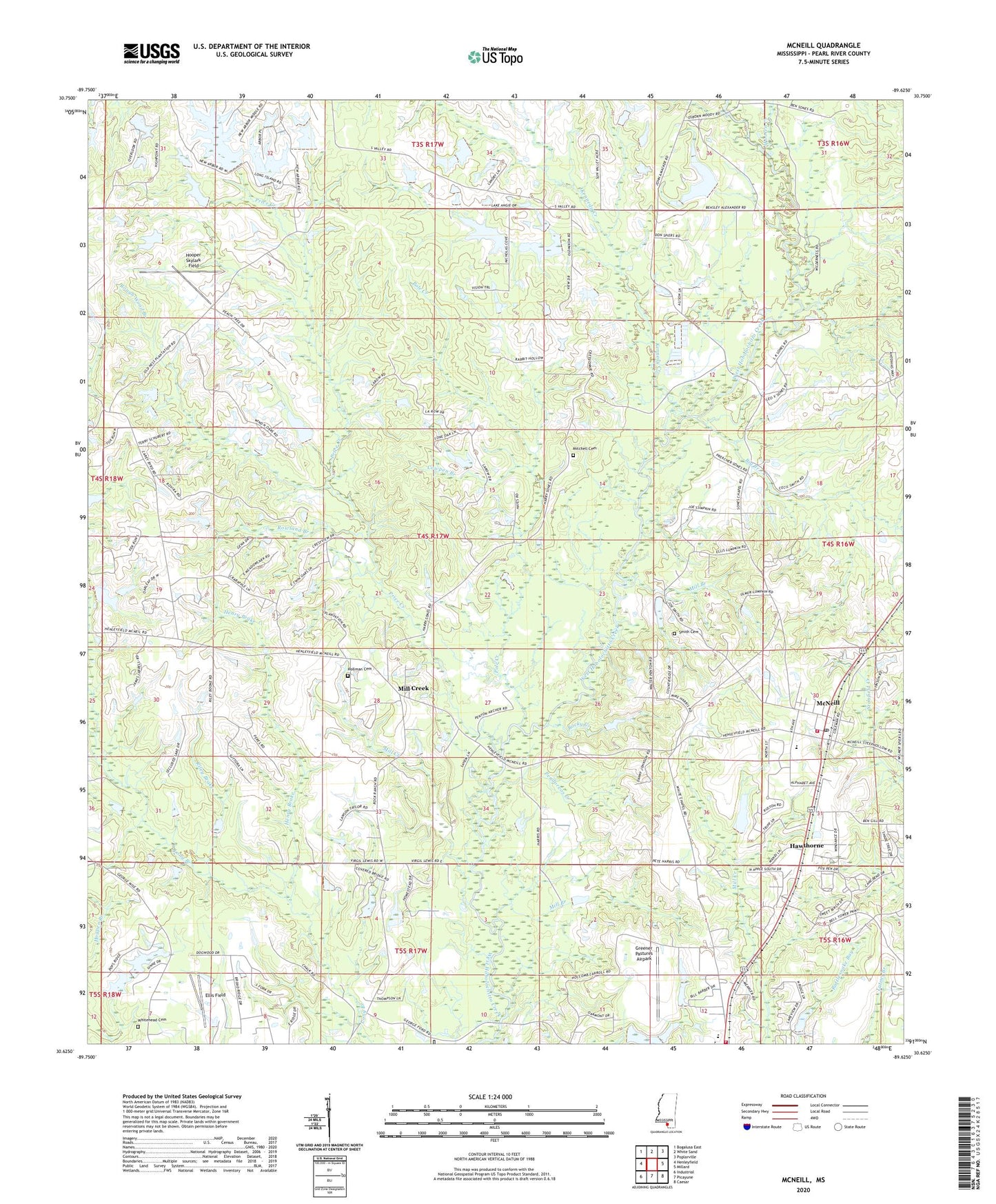
2020 topographic map quadrangle McNeill in the state of Mississippi. Scale: 1:24000. Based on the newly updated USGS 7.5' US Topo map series, this map is in the following counties: Pearl River. The map contains contour data, water features, and other items you are used to seeing on USGS maps, but also has updated roads and other features. This is the next generation of topographic maps. Printed on high-quality waterproof paper with UV fade-resistant inks.
Quads adjacent to this one:
West: Henleyfield
Northwest: Bogalusa East
North: White Sand
Northeast: Poplarville
East: Millard
Southeast: Caesar
South: Picayune
Southwest: Industrial
Contains the following named places: Big Branch, Carriere Volunteer Fire Department Station 1 Headquarters, Central Baptist Church, Cowpen Branch, Crosby Chemical Company Lake Dam, Ellis Field, First Apostolic Church of McNeill, First Baptist Church, Ford Church, Greener Pastures Airpark, Hawthorne, Henry Brake, Hollman Cemetery, Hooper Skylark Field, Kennedy Creek, Lacy Lookout Tower, Langhurst Airport, Lee Chapel, McNeill, McNeill Post Office, McNeill Volunteer Fire Department, McNeill Volunteer Fire Department Substation, Mill Branch, Mill Creek, Mill Creek School, Mitchell Cemetery, Pearl River Central High School, Pearl River Central Upper Elementary School, Pendorvos Creek, Penton School, Pole Creek, Price Creek, Riley Brake, Rocky Creek, Roger Turners Lake Dam, Rough Wood Branch, Rowland Branch, Smith Cemetery, Sones Chapel, W H Amacker Lake Dam, White Chapel, Whitehead Cemetery, Wooten Creek, Zion Hill Baptist Church, ZIP Code: 39426