MyTopo
Holmesville Mississippi US Topo Map
Couldn't load pickup availability
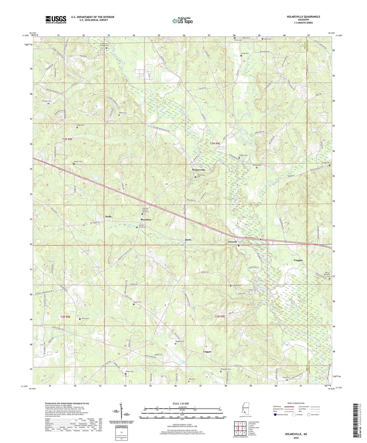
2024 topographic map quadrangle Holmesville in the state of Mississippi. Scale: 1:24000. Based on the newly updated USGS 7.5' US Topo map series, this map is in the following counties: Pike, Walthall. The map contains contour data, water features, and other items you are used to seeing on USGS maps, but also has updated roads and other features. This is the next generation of topographic maps. Printed on high-quality waterproof paper with UV fade-resistant inks.
Quads adjacent to this one:
West: McComb South
Northwest: McComb North
North: Pricedale
Northeast: Jayess
East: Mesa
Southeast: Tylertown
South: Progress
Southwest: Osyka
This map covers the same area as the classic USGS quad with code o31090b3.
Contains the following named places: Alford Cemetery, Andrews-Bickam-Quin Cemetery, Bars Branch, Barto, Beardens, Brent Cemetery, Brent School, Bridges, Brumfield Cemetery, Charles Young Cemetery, Church of Christ, Conerly, Conerly Cemetery, Connally Cemetery, Ellzey Cemetery, Gray Cemetery, Hardscrabble Plantation, HM Lee Memorial Cemetery, Holmesville, Holmesville Baptist Church, Holmesville Cemetery, House of Prayer Church, Howell Lake Dam, Kaigler Cemetery, Leatherwood Creek, Leatherwood School, Leggett, Leggett Cemetery, Martin - McNabb Cemetery, Martin Cemetery, Martins School, Mount Cannon Church, New Holmesville, Parker Lake Dam, Pink Hill Church, Pleasant Grove Church, Pleasant Valley Church of God in Christ, Rills Cemetery, Saint James Church, Sibley School, Stella, Supervisor District 3, Thomas Cemetery, Topisaw Creek, Vaughts, Walker Cemetery, Warner Cemetery, Webb Cemetery, Wingo Cemetery