MyTopo
Sherard Mississippi US Topo Map
Couldn't load pickup availability
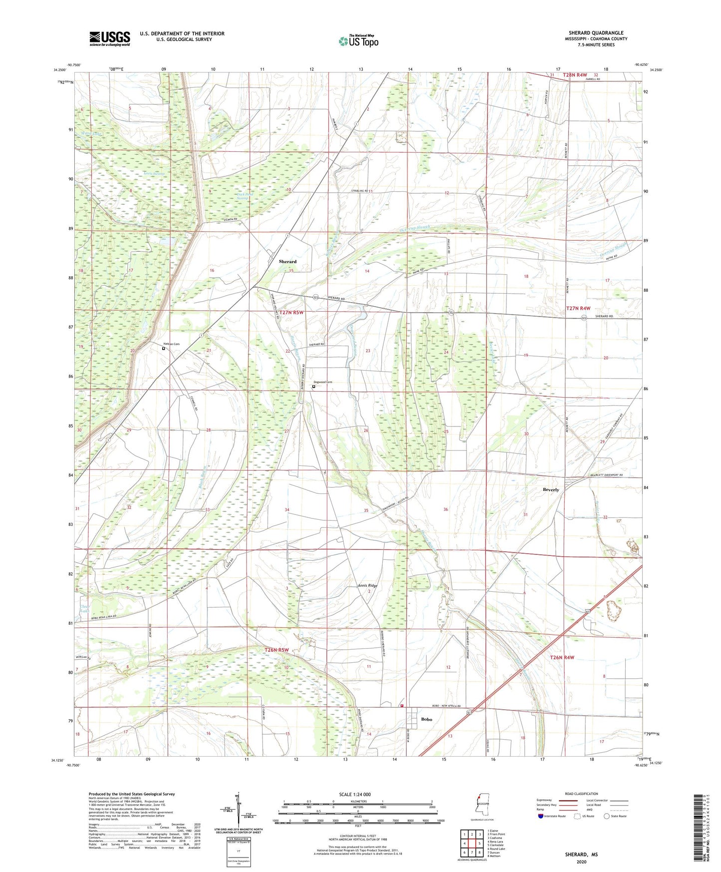
2020 topographic map quadrangle Sherard in the state of Mississippi. Scale: 1:24000. Based on the newly updated USGS 7.5' US Topo map series, this map is in the following counties: Coahoma. The map contains contour data, water features, and other items you are used to seeing on USGS maps, but also has updated roads and other features. This is the next generation of topographic maps. Printed on high-quality waterproof paper with UV fade-resistant inks.
Quads adjacent to this one:
West: Rena Lara
Northwest: Elaine
North: Friars Point
Northeast: Coahoma
East: Clarksdale
Southeast: Mattson
South: Duncan
Southwest: Round Lake
Contains the following named places: Annis Brake, Annis Ridge, Baugh, Baugh School, Beautiful Zion Church, Beverly, Black Bayou, Bobo, Bobo Census Designated Place, Coahoma County Volunteer Fire Department Bobo, Dogwood Bayou, Dogwood Cemetery, Duck Pond Swamp, East Stover School, Lewis Swamp, Macedonia Church, Magnolia Church, Morning Glory Church, Mound Church, Mount Olive Church, Mount Zion Church, Nathan Cemetery, Overcup Slough, Peters Rock Church, Pleasant Grove Church, Pullen, Richies Bayou, Rosenwald School, Sherard, Sherard Elementary School, Shiloh Church, Sycamore Grove Church, Sycamore Grove School, WAID-FM (Clarksdale)