MyTopo
Taylorsville Mississippi US Topo Map
Couldn't load pickup availability
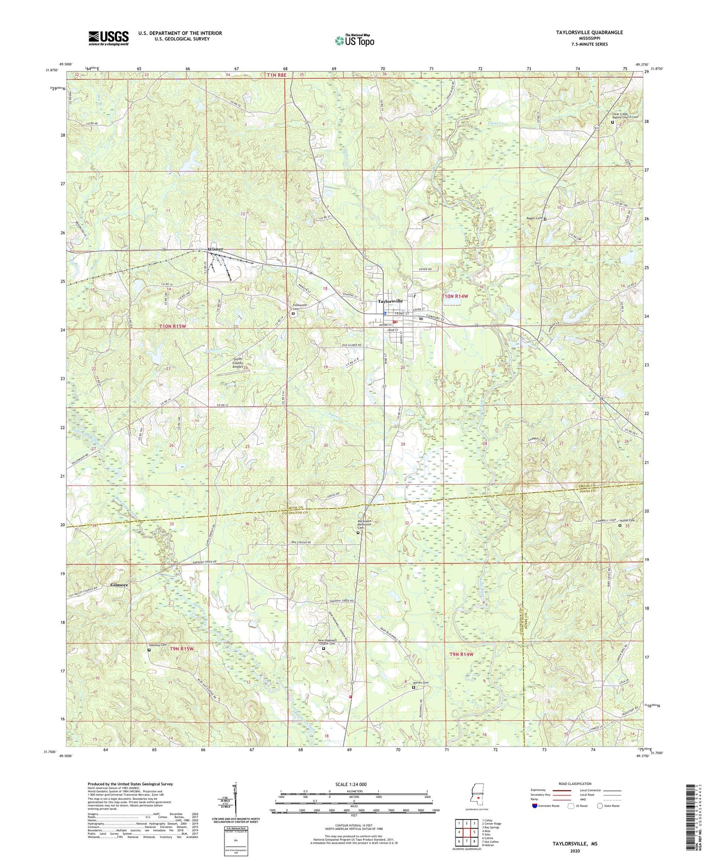
2024 topographic map quadrangle Taylorsville in the state of Mississippi. Scale: 1:24000. Based on the newly updated USGS 7.5' US Topo map series, this map is in the following counties: Smith, Covington, Jones. The map contains contour data, water features, and other items you are used to seeing on USGS maps, but also has updated roads and other features. This is the next generation of topographic maps. Printed on high-quality waterproof paper with UV fade-resistant inks.
Quads adjacent to this one:
West: Mize
Northwest: Cohay
North: Center Ridge
Northeast: Bay Springs
East: Soso
Southeast: Hebron
South: Hot Coffee
Southwest: Collins
This map covers the same area as the classic USGS quad with code o31089g4.
Contains the following named places: Anderson Lake Dam, Barnes Cemetery, Belmont Church, Belmont School, Cherry Grove Church, Clear Creek, Clear Creek Baptist Church, Clear Creek Baptist Church Cemetery, Cold Creek Lake Dam, Fellowship Church, First Baptist Church, First Church, First Presbyterian Church, Fisher Creek, Gambrell, Gilmer Methodist Church, Gilmer School, Gilmore, Gilmore Baptist Church, Gravel Hill School, Hill Lake Dam, Hinton Cemetery, Hot Coffee Volunteer Fire Department Station 2, Lyon Creek, Mayfield Lake Dam, New Hopewell Church, New Hopewell Church Cemetery, New Hopewell School, Oakohay Cemetery, Ocohay, Okahay Baptist Church, Old Taylorsville, Palestine Church, Ross R Barnett Lake Dam, Smith County Airport, Sullivans Hollow Creek, Summerland Oil and Gas Field, Taylorsville, Taylorsville Elementary School, Taylorsville High School, Taylorsville Police Department, Taylorsville Post Office, Taylorsville Sewage Lagoon Dam, Town of Taylorsville, Walker School, Wisner, Wisner Oil Field, WSCO-AM (Taylorsville), ZIP Code: 39168