MyTopo
Whites Mississippi US Topo Map
Couldn't load pickup availability
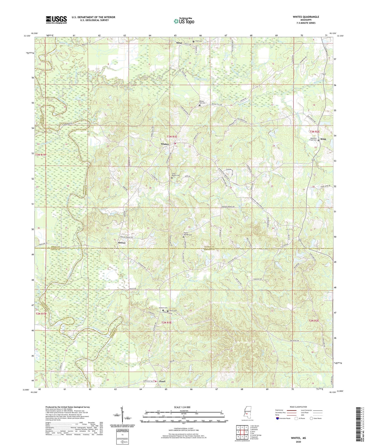
2020 topographic map quadrangle Whites in the state of Mississippi. Scale: 1:24000. Based on the newly updated USGS 7.5' US Topo map series, this map is in the following counties: Rankin, Simpson, Hinds, Copiah. The map contains contour data, water features, and other items you are used to seeing on USGS maps, but also has updated roads and other features. This is the next generation of topographic maps. Printed on high-quality waterproof paper with UV fade-resistant inks.
Quads adjacent to this one:
West: Terry
Northwest: New Byram
North: Florence
Northeast: Whitfield
East: Star
Southeast: Harrisville
South: Hopewell
Southwest: Crystal Springs
Contains the following named places: Almadale, Alonzo, Antioch Baptist Church, Antioch Cemetery, Bear Creek, Brown Hill Cemetery, Brown Hill Church, Chestnut Creek, Clear Branch, Clear Branch Cemetery, Clear Branch Church, County Line School, Crawford Lake Dam, Dears Ferry, Dimes Ferry, Doctor David Wilson Lake Dam, Enochs Mill, Fortners Ferry, French Branch, Haley Creek, Hickory Creek, Holcomb Branch, Hominy Creek, James Jones Lake Dam, King, Lewis Cemetery, Loflin Lake Dam, Mount Zion Church, Mountain Creek, Mountain Creek Cemetery, Old Pearl Volunteer Fire Department, Pearl, Poplar Springs Cemetery, Poplar Springs Church, Presbyterian Church Lakes Dam, Raymond Brothers Lake Dam, Rhodes Creek, Rock Hill Lookout Tower, Rocky Creek, Rocky Creek School, Rocky Spring Church, Sinai, Sinai Cemetery, Southwest Rankin Fire Department, Steen Creek, Vaughn Creek, Whites, Zion Hill Church, ZIP Code: 39073