MyTopo
Agency Missouri US Topo Map
Couldn't load pickup availability
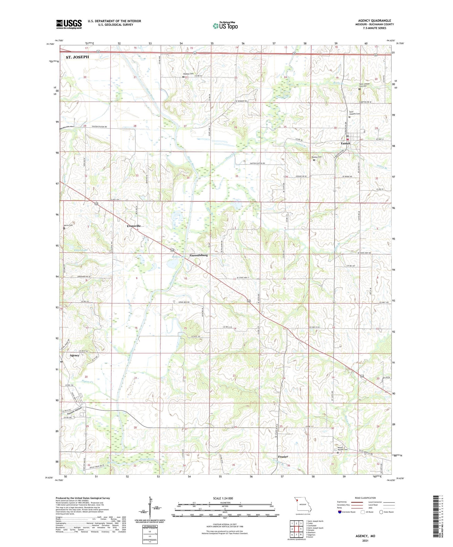
2021 topographic map quadrangle Agency in the state of Missouri. Scale: 1:24000. Based on the newly updated USGS 7.5' US Topo map series, this map is in the following counties: Buchanan. The map contains contour data, water features, and other items you are used to seeing on USGS maps, but also has updated roads and other features. This is the next generation of topographic maps. Printed on high-quality waterproof paper with UV fade-resistant inks.
Quads adjacent to this one:
West: Saint Joseph South
Northwest: Saint Joseph North
North: Cosby
Northeast: Clarksdale
East: Hemple
Southeast: Gower
South: Edgerton
Southwest: Dearborn
This map covers the same area as the classic USGS quad with code o39094f6.
Contains the following named places: Agency, Agency Post Office, Becks Branch, Blakely Cemetery, Camp Marvin Hillyard, Candy Creek, City of Easton, East Buchanan Middle School, Easton, Easton Fire Protection District, Easton Post Office, Ebenezer Church, Ebenezer School, Ehlert Lake, Ehlert Lake Dam, Evansville, Fairview School, Frazer School, Frazier, Garrettsburg, Gibson School, Greener School, Holmes School, James Branch, Karns Cemetery, KKJO-AM (St Joseph), KTAJ-TV (St Joseph), Malden School, Midway Church, Millers Lake, Moore School, Mount Moriah Cemetery, Mount Moriah Church, Moxley Cemetery, Oakland School, One Hundred and Two River, Pigeon Creek, Platte River, Possum Hollow, Riley Branch, Rock Creek, Rockhouse School, Saint Joseph Cemetery Old, Saint Josephs Cemetery, Stamper School, Third Fork, Thompson Lake, Township of Agency, Township of Tremont, Village of Agency, Woodbury Lake, Woodbury Lake Dam, ZIP Codes: 64401, 64443