MyTopo
Edgerton Missouri US Topo Map
Couldn't load pickup availability
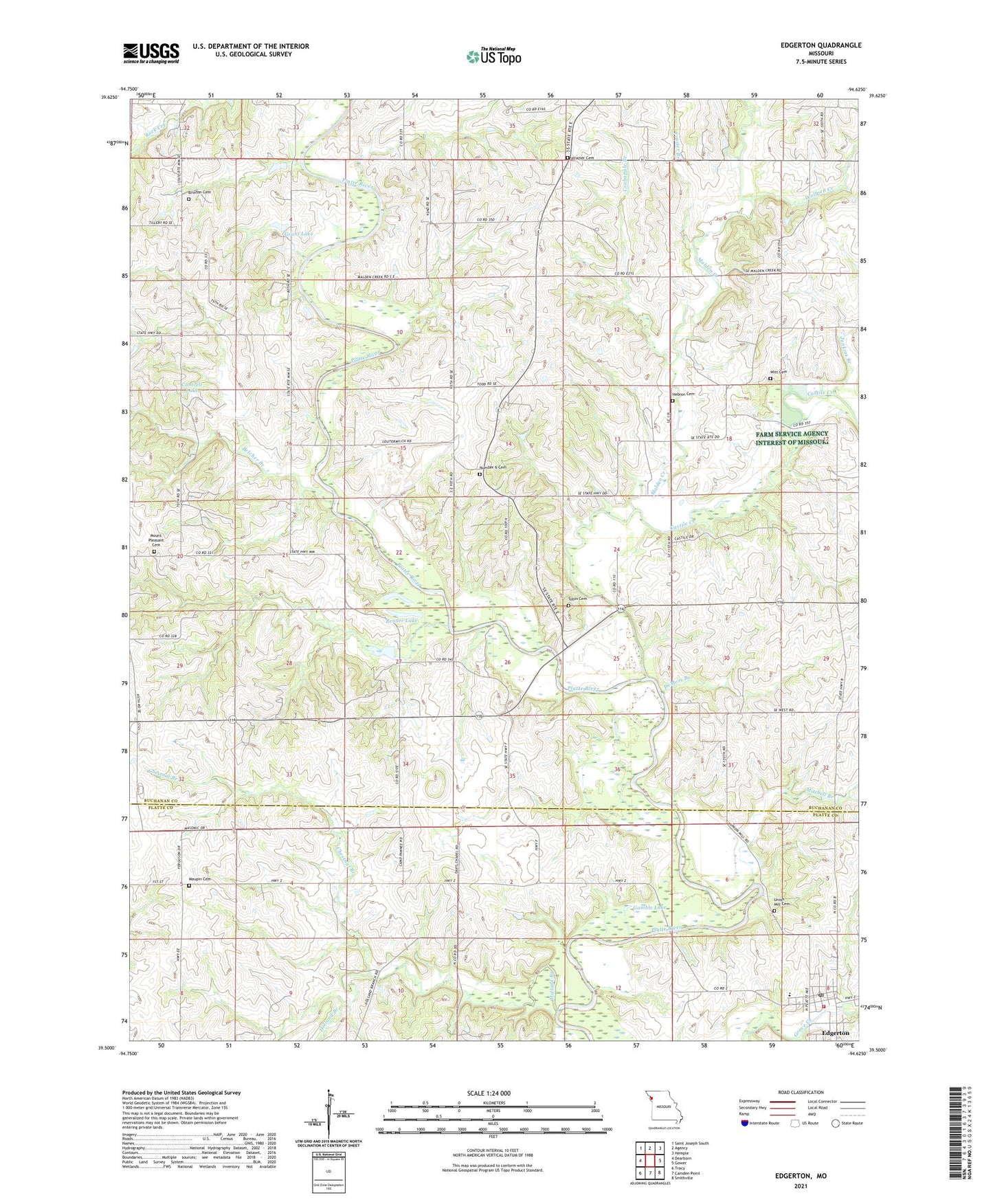
2021 topographic map quadrangle Edgerton in the state of Missouri. Scale: 1:24000. Based on the newly updated USGS 7.5' US Topo map series, this map is in the following counties: Buchanan, Platte. The map contains contour data, water features, and other items you are used to seeing on USGS maps, but also has updated roads and other features. This is the next generation of topographic maps. Printed on high-quality waterproof paper with UV fade-resistant inks.
Quads adjacent to this one:
West: Dearborn
Northwest: Saint Joseph South
North: Agency
Northeast: Hemple
East: Gower
Southeast: Smithville
South: Camden Point
Southwest: Tracy
This map covers the same area as the classic USGS quad with code o39094e6.
Contains the following named places: Arnoldsville School, Belcher Branch, Benner Lake, Brinton Cemetery, Bruce School, Burnett School, Cantrell Dam, Cantrell Lake, Castile Creek, Chestnut Branch, City of Edgerton, Crabapple Branch, Davis Chapel, DeMoss Branch, Edgerton, Edgerton - Trimble Fire Protection District Station 1, Edgerton Post Office, Frazier Branch, Frazier Cemetery, Frazier Church, Gamble Lake, Grant Lake, Grant Lake Dam - North, Grant Lake Dam - South, Hebron Cemetery, Hebron Church, Holland Branch, Jenkins Branch, KSFT-FM (St Joseph), Malden Creek, Matheys Mill, Maupin Cemetery, McGauhey School, Middleton Dam, Middleton Lake, Mitchell Branch, Mount Pleasant Cemetery, New Frame Church, North Platte Intermediate School, Number 6 Cemetery, Phelps School, Platte River, Rising Sun School, School Number 5, School Number 6, Sherwood School, Tobin Cemetery, Township of Jackson, Township of Platte, Union Mill Cemetery, Union Mill School, Witt Cemetery, Wolfpen Creek