MyTopo
Bernie Missouri US Topo Map
Couldn't load pickup availability
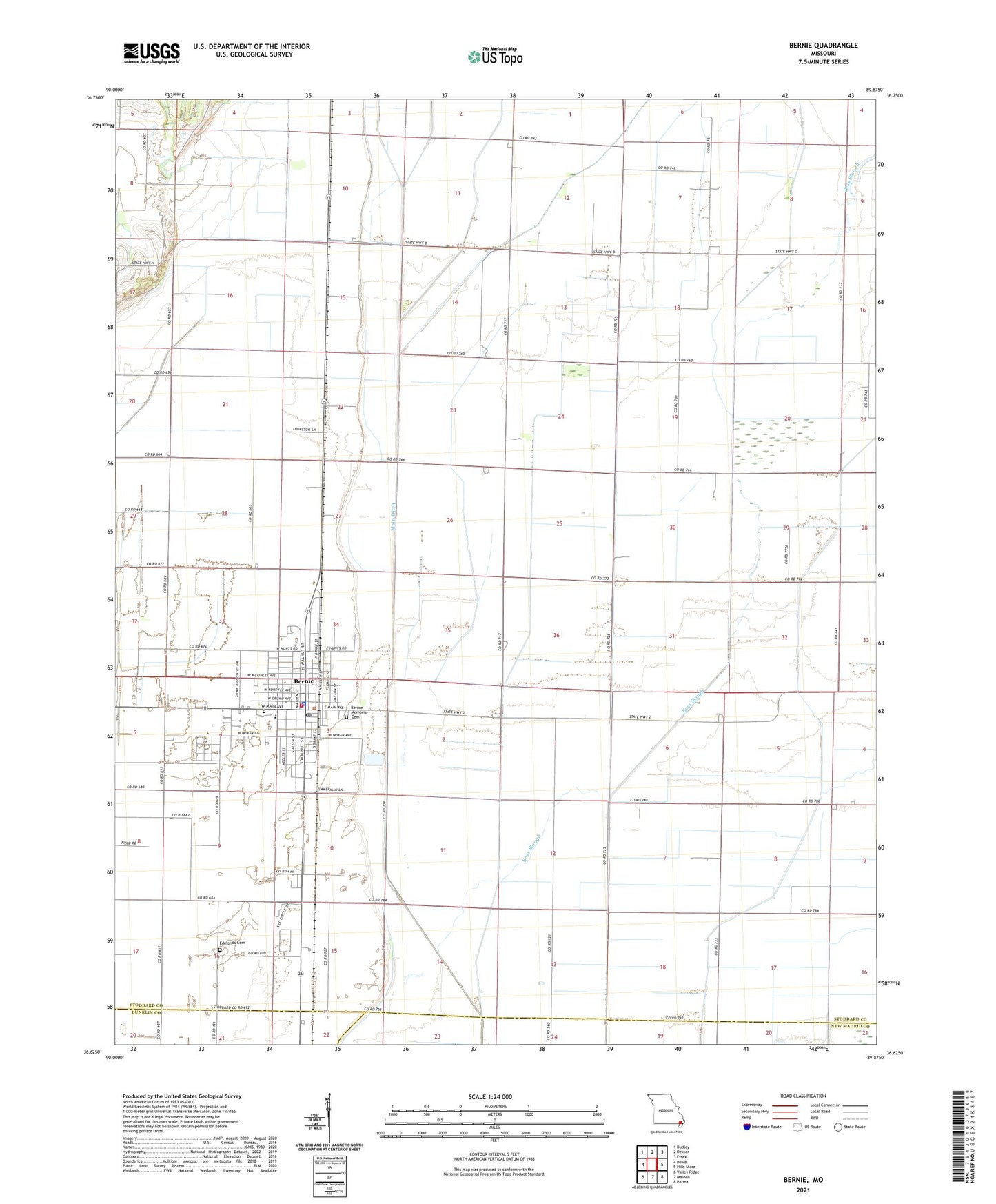
2021 topographic map quadrangle Bernie in the state of Missouri. Scale: 1:24000. Based on the newly updated USGS 7.5' US Topo map series, this map is in the following counties: Stoddard, New Madrid, Dunklin. The map contains contour data, water features, and other items you are used to seeing on USGS maps, but also has updated roads and other features. This is the next generation of topographic maps. Printed on high-quality waterproof paper with UV fade-resistant inks.
Quads adjacent to this one:
West: Powe
Northwest: Dudley
North: Dexter
Northeast: Essex
East: Hills Store
Southeast: Parma
South: Malden
Southwest: Valley Ridge
Contains the following named places: Bernie, Bernie Fire Department, Bernie Police Department, Bernie Post Office, Bess Slough, Bunker Hill, Bunker Hill School, City of Bernie, Dickerson School, Edmonds Cemetery, Guide Star School, Hazel, Lampher Chapel, Last Chance Church, Liberty Corner Church, Main Ditch, Miller, New Hope Church, New Prospect Church, Oak Grove School, Out, Poplin School, Smith School, Sugar Tree Church, Sugar Tree School, Sweet Prospect Church, ZIP Code: 63822