MyTopo
Essex Missouri US Topo Map
Couldn't load pickup availability
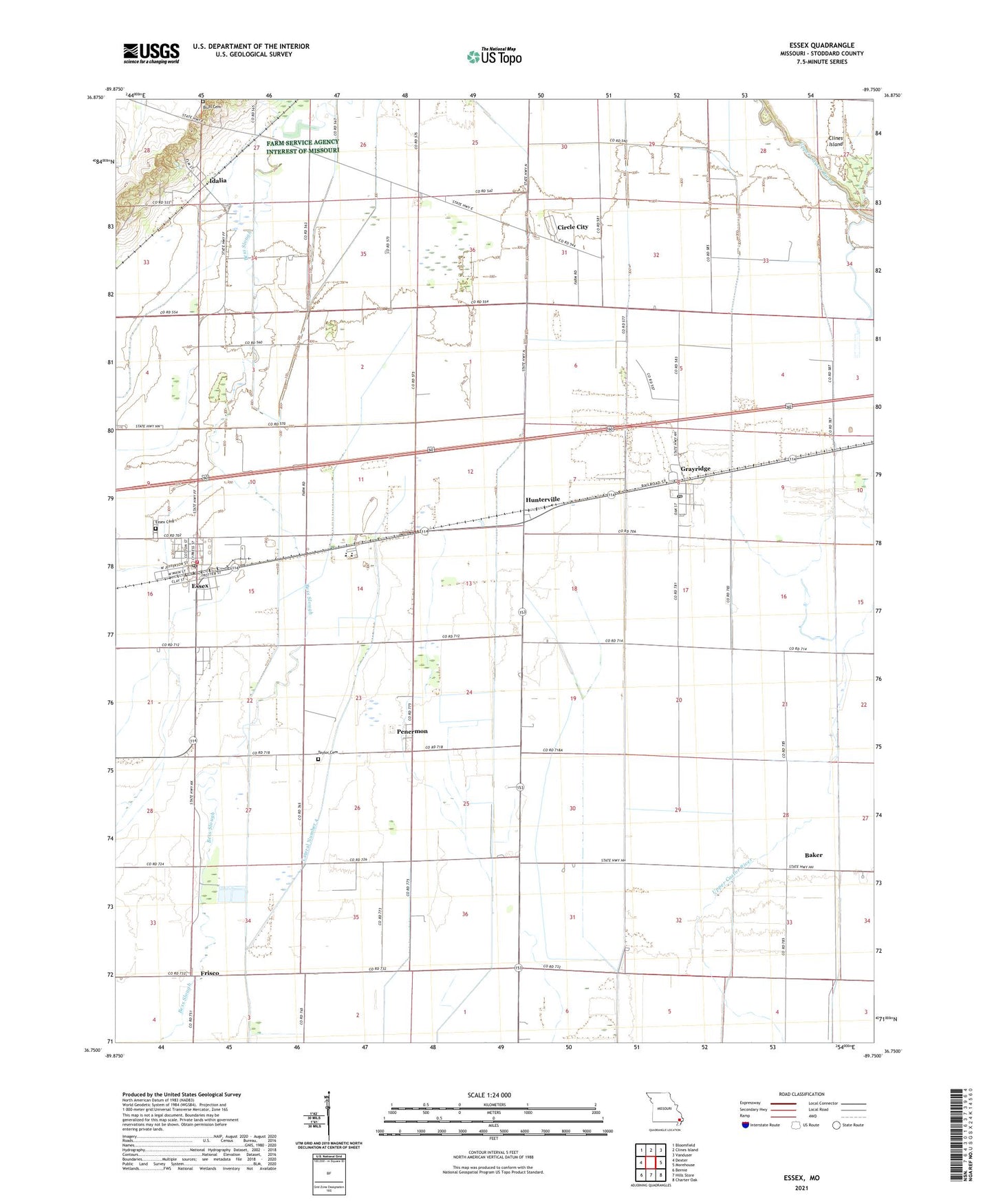
2021 topographic map quadrangle Essex in the state of Missouri. Scale: 1:24000. Based on the newly updated USGS 7.5' US Topo map series, this map is in the following counties: Stoddard. The map contains contour data, water features, and other items you are used to seeing on USGS maps, but also has updated roads and other features. This is the next generation of topographic maps. Printed on high-quality waterproof paper with UV fade-resistant inks.
Quads adjacent to this one:
West: Dexter
Northwest: Bloomfield
North: Clines Island
Northeast: Vanduser
East: Morehouse
Southeast: Charter Oak
South: Hills Store
Southwest: Bernie
This map covers the same area as the classic USGS quad with code o36089g7.
Contains the following named places: 101 School, 63846, Allstum School, Baker, Bluff Cemetery, Bluff School, Circle City, City of Essex, Essex, Essex Police Department, Essex Post Office, Essex Volunteer Fire Department, Frisco, Frisco School, Galloway School, Grayridge, Grayridge Census Designated Place, Grayridge Post Office, Holly School, Hunterville, Idalia, Lateral Number 4, Lone Star School, Mount Zion Church, Olive Branch Church, Penermon, Pin Hook School, Saint Joe Church, Skagg School, South Richland School, Taylor Church, Taylor School, Township of Richland, Trotter Church, Trotter School, Village of Baker, Village of Penermon