MyTopo
Malden Missouri US Topo Map
Couldn't load pickup availability
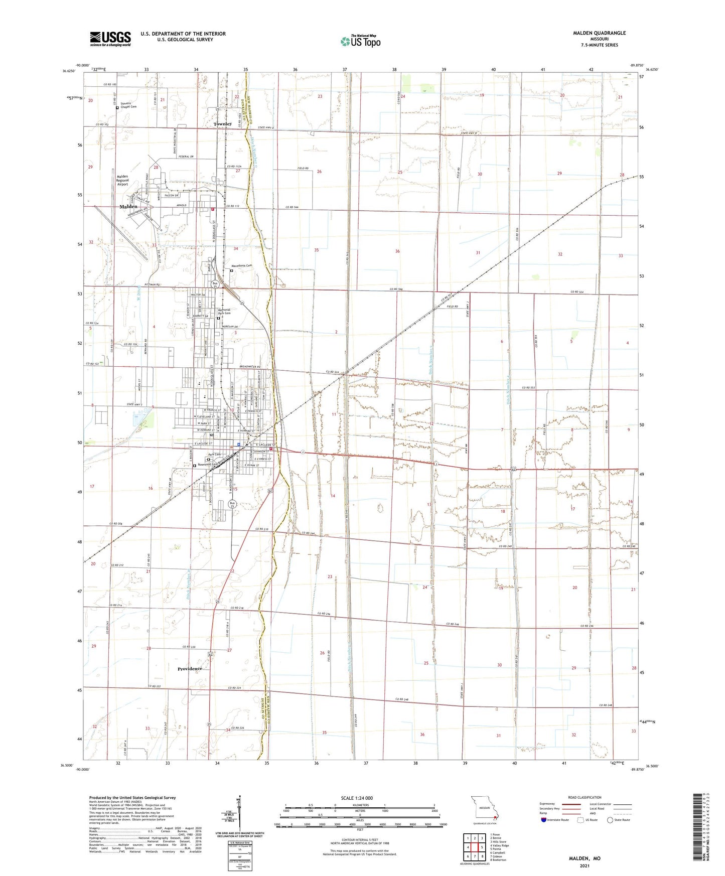
2021 topographic map quadrangle Malden in the state of Missouri. Scale: 1:24000. Based on the newly updated USGS 7.5' US Topo map series, this map is in the following counties: New Madrid, Dunklin. The map contains contour data, water features, and other items you are used to seeing on USGS maps, but also has updated roads and other features. This is the next generation of topographic maps. Printed on high-quality waterproof paper with UV fade-resistant inks.
Quads adjacent to this one:
West: Valley Ridge
Northwest: Powe
North: Bernie
Northeast: Hills Store
East: Parma
Southeast: Boekerton
South: Gideon
Southwest: Campbell
This map covers the same area as the classic USGS quad with code o36089e8.
Contains the following named places: Baxter, Bethel Church, Broadwater, Broadwater Airport, Broadwater School, Carver Switch, City of Malden, Ditch Number 0, Ditch Number 2, Ditch Number 3, Ditch Number 4, Ditch Number 5, Five Point, Full Gospel Mission, KMAL-FM (Malden), KTCB-AM (Malden), Liberty School, Lone Oak Church, Macedonia Cemetery, Malden, Malden Army Air Field, Malden City Hall, Malden Fire Department Station 2, Malden High School, Malden Police Department, Malden Post Office, Malden Regional Airport, Malden Volunteer Fire Department Station 1, Maple Grove Church, Maple Grove School, Melby, Memorial Park Cemetery, New Hope School, Nordlow, Old Phillips School, Park Cemetery, Phillips, Pilgrims Rest Church, Pilgrims Rest School, Providence, Providence School, Ruma, Sommers, Spoonerville, Stevens Chapel Cemetery, Stubblefield School, The Lighthouse Church, Townley, Township of Cotton Hill, Turner, West Ditch, ZIP Code: 63863