MyTopo
Parma Missouri US Topo Map
Couldn't load pickup availability
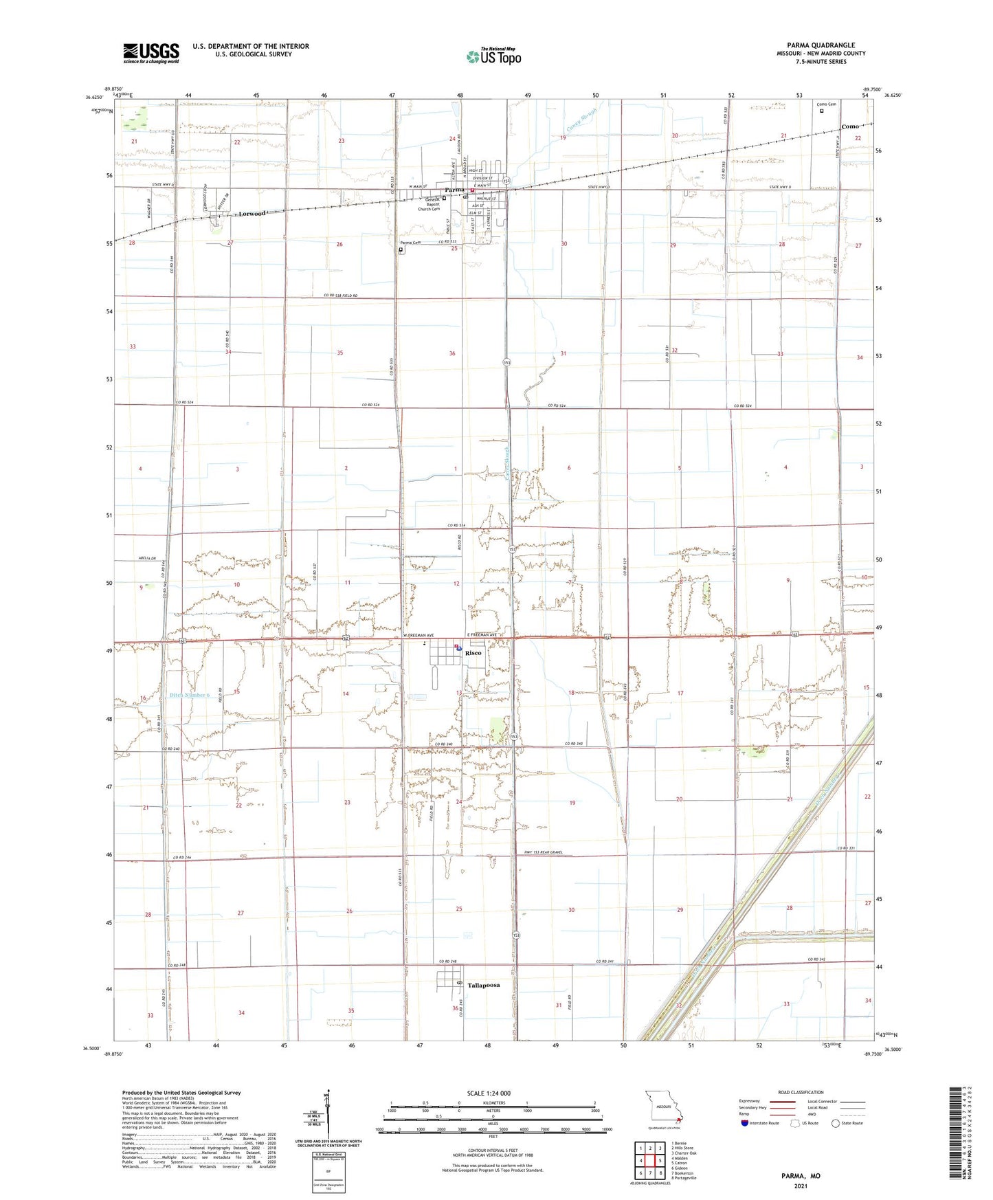
2021 topographic map quadrangle Parma in the state of Missouri. Scale: 1:24000. Based on the newly updated USGS 7.5' US Topo map series, this map is in the following counties: New Madrid. The map contains contour data, water features, and other items you are used to seeing on USGS maps, but also has updated roads and other features. This is the next generation of topographic maps. Printed on high-quality waterproof paper with UV fade-resistant inks.
Quads adjacent to this one:
West: Malden
Northwest: Bernie
North: Hills Store
Northeast: Charter Oak
East: Catron
Southeast: Portageville
South: Boekerton
Southwest: Gideon
This map covers the same area as the classic USGS quad with code o36089e7.
Contains the following named places: Caney Slough, City of Parma, City of Risco, City of Tallapoosa, Como, Como Cemetery, Crumpecker, Dillingham Spring, Ditch Number 44, Ditch Number 6, Ditch Number 7, Forest Spur, Hyman School, Jerico School, Jones School, Lorwood, Mount Zion Church, Oak Island School, Oak Ridge School, Parma, Parma Cemetery, Parma Police Department, Parma Post Office, Parma Volunteer Fire Department, Pinder School, Risco, Risco Fire Department, Risco Police Department, Risco Post Office, Risco Rural Fire Department, Tallapoosa, Tallapoosa Post Office, Township of Como, Wila, ZIP Codes: 63870, 63874, 63878