MyTopo
Powe Missouri US Topo Map
Couldn't load pickup availability
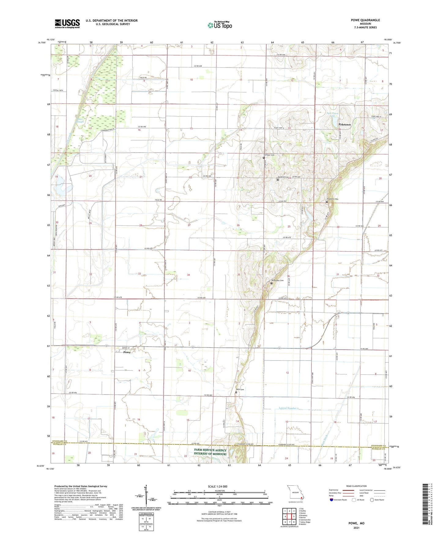
2021 topographic map quadrangle Powe in the state of Missouri. Scale: 1:24000. Based on the newly updated USGS 7.5' US Topo map series, this map is in the following counties: Stoddard, Dunklin. The map contains contour data, water features, and other items you are used to seeing on USGS maps, but also has updated roads and other features. This is the next generation of topographic maps. Printed on high-quality waterproof paper with UV fade-resistant inks.
Quads adjacent to this one:
West: Broseley
Northwest: Fisk
North: Dudley
Northeast: Dexter
East: Bernie
Southeast: Malden
South: Valley Ridge
Southwest: Glennonville
This map covers the same area as the classic USGS quad with code o36090f1.
Contains the following named places: Blackburn, Boone, Boyd School, Brady School, Bradyville, Bridge Church, Bridge School, County Line Ditch Lateral Number 1, Cyrus, District School Number 96, Fish Slough, Ivester School, Lateral Number 2, McMurphy Cemetery, Mills Cemetery, Otter Slough, Otter Slough Ditch, Otter Slough State Wildlife Management Area, Overcup Pond, Pleasant Grove Church, Powe, Powe Census Designated Place, Pyle Town Lake, Pyletown, Shiloh Church, Shover, Shreve, South White Oak School, Stephens Cemetery, Summer Cemetery, Sycamore Cemetery, Sycamore Church, Temples Lake Dam, Thomason Lake Dam, Township of Liberty, White Oak Grove Church, White Oak School