MyTopo
Dexter Missouri US Topo Map
Couldn't load pickup availability
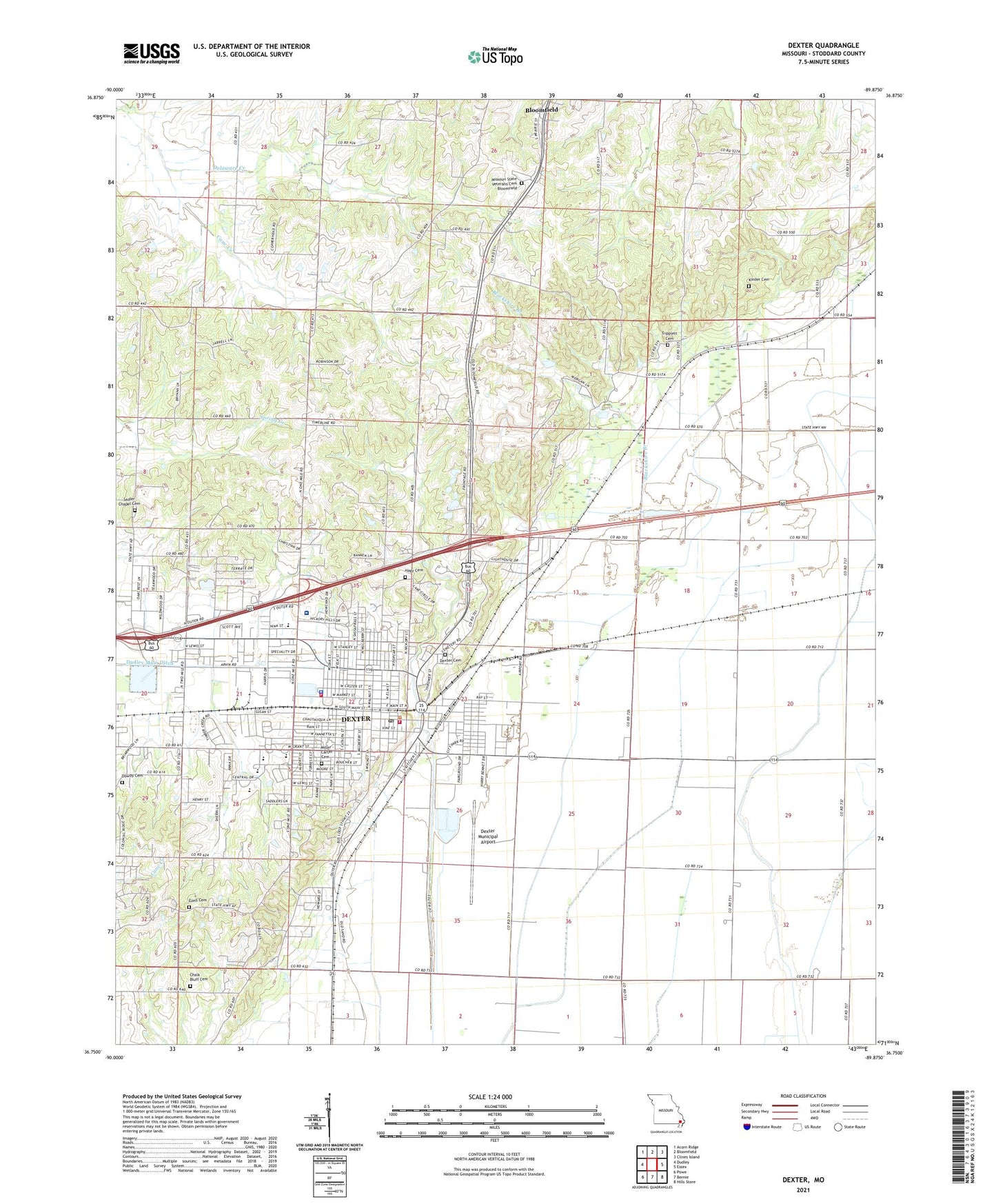
2021 topographic map quadrangle Dexter in the state of Missouri. Scale: 1:24000. Based on the newly updated USGS 7.5' US Topo map series, this map is in the following counties: Stoddard. The map contains contour data, water features, and other items you are used to seeing on USGS maps, but also has updated roads and other features. This is the next generation of topographic maps. Printed on high-quality waterproof paper with UV fade-resistant inks.
Quads adjacent to this one:
West: Dudley
Northwest: Acorn Ridge
North: Bloomfield
Northeast: Clines Island
East: Essex
Southeast: Hills Store
South: Bernie
Southwest: Powe
This map covers the same area as the classic USGS quad with code o36089g8.
Contains the following named places: Bartletts Fishing Lake Dam, Blackshire Branch, Cane Creek, Central School, Chalk Bluff Cemetery, City of Dexter, Dexter, Dexter Cemetery, Dexter Creek, Dexter Fire Department Station 2, Dexter Fire Department Station 3, Dexter Junction, Dexter Memorial Hospital Heliport, Dexter Municipal Airport, Dexter Police Department, Dexter Post Office, Dowdy Cemetery, East Park, Edwards School, Ezell Cemetery, Ezell School, Gilead Hills Church, Hagy Cemetery, Hill School, Jerusalem Church, KDEX-AM (Dexter), KDEX-FM (Dexter), Kinder Cemetery, Lambert School, Lost School, Miller - Carter Cemetery, Missouri State Veterans Cemetery - Bloomfield, New Bethel Church, Ott School, Panther Swamp, Pleasant Valley Church, Renner School, Sadler Chapel Cemetery, Southeast Health Medical Center Stoddard County, Southwest School, Stoddard County, Tatum School, Walnut Ridge School, ZIP Code: 63841