MyTopo
Bible Grove Missouri US Topo Map
Couldn't load pickup availability
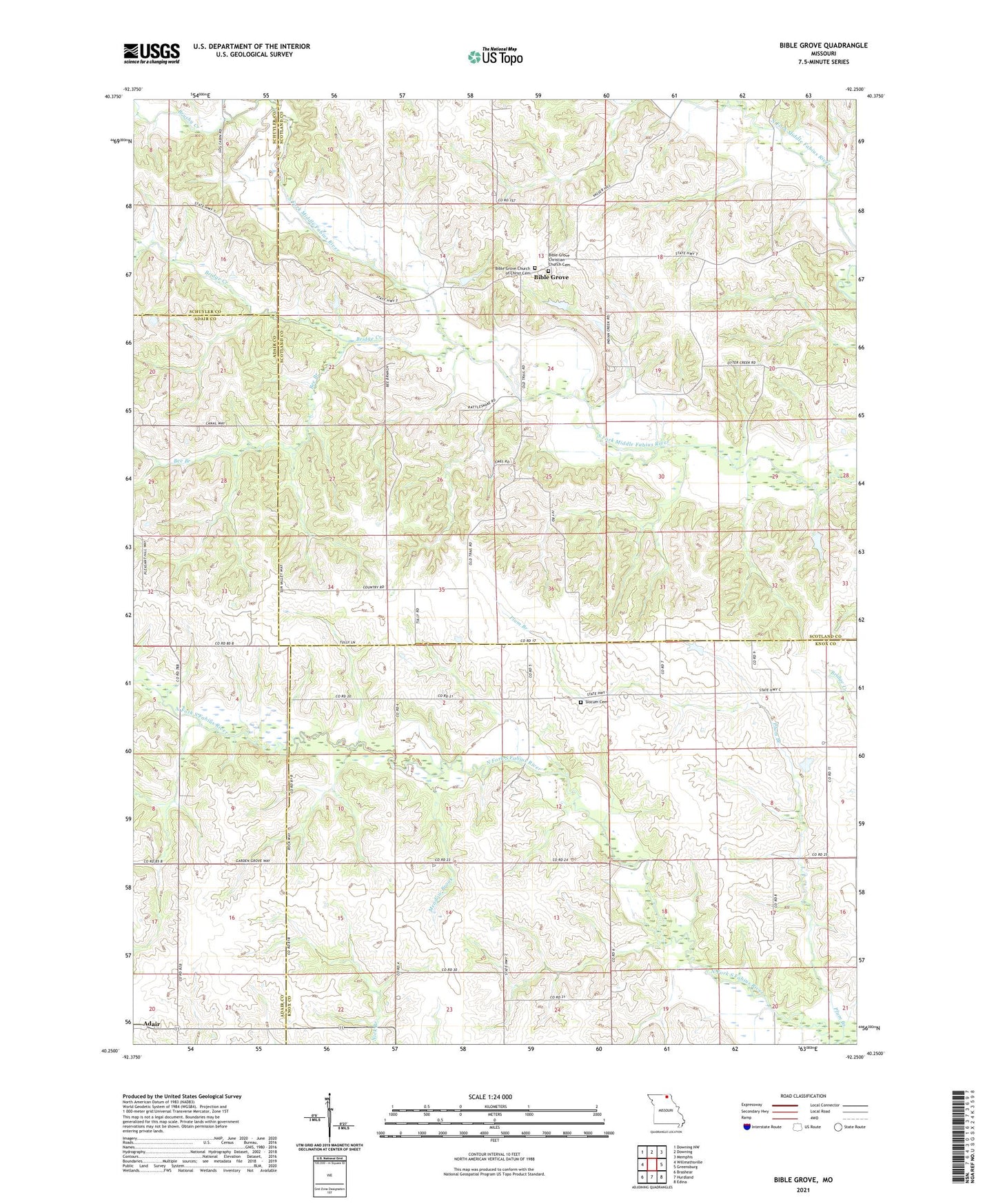
2021 topographic map quadrangle Bible Grove in the state of Missouri. Scale: 1:24000. Based on the newly updated USGS 7.5' US Topo map series, this map is in the following counties: Scotland, Knox, Adair, Schuyler. The map contains contour data, water features, and other items you are used to seeing on USGS maps, but also has updated roads and other features. This is the next generation of topographic maps. Printed on high-quality waterproof paper with UV fade-resistant inks.
Quads adjacent to this one:
West: Willmathsville
Northwest: Downing NW
North: Downing
Northeast: Memphis
East: Greensburg
Southeast: Edina
South: Hurdland
Southwest: Brashear
This map covers the same area as the classic USGS quad with code o40092c3.
Contains the following named places: Bee Branch, Bible Grove, Bible Grove Christian Church Cemetery, Bible Grove Church of Christ Cemetery, Bridge Creek, Brushy Creek, Gaylen Hill Dam, Hazelville, Knob View School, Meadow Brook, Meadow Brook School, Miller School, Old Buzzard School, Pleasant Ridge Church, Plum Branch, Rowland-Klopfenstein Lake Dam, Slocum Cemetery, Swearingen Lake Dam, Township of Greensburg, Township of Mount Pleasant, Walter R Tompson Dam