MyTopo
Vienna Missouri US Topo Map
Couldn't load pickup availability
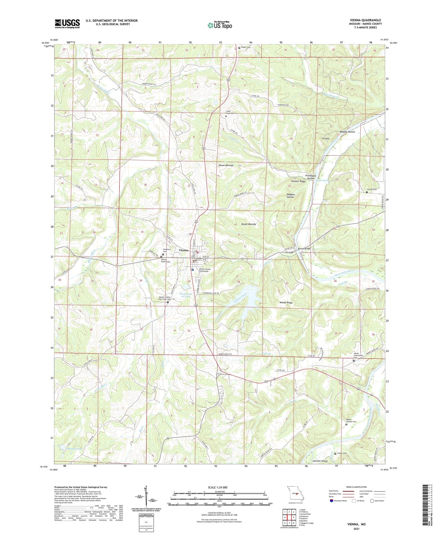
2021 topographic map quadrangle Vienna in the state of Missouri. Scale: 1:24000. Based on the newly updated USGS 7.5' US Topo map series, this map is in the following counties: Maries. The map contains contour data, water features, and other items you are used to seeing on USGS maps, but also has updated roads and other features. This is the next generation of topographic maps. Printed on high-quality waterproof paper with UV fade-resistant inks.
Quads adjacent to this one:
West: Brinktown
Northwest: Argyle
North: Freeburg
Northeast: Summerfield
East: Paydown
Southeast: Vichy
South: Nagogami Lodge
Southwest: Big Bend
This map covers the same area as the classic USGS quad with code o38091b8.
Contains the following named places: Bloom Garden Cemetery, Bloom Garden School, Bowman Lake Dam, Cairns, City of Vienna, Crumb Creek, Daggett Hollow, Feeler Cemetery, Fly Creek, House Mounds, Indian Creek, Indian Ford Lakes, Indian Village Site, Irish Branch, Jack Creek, James Brothers, Jim Creek, Johnson Ford, Johnson Island, Keiser Branch, Lanes Ford, Lanes Spring, Little Flock School, Little Fly Creek, Maries County, Maries County Memorial Park, Maries County Sheriff's Office, Mononame 67 Lake, Murphey Lake Dam, Murphy Lake, Plowbeam Hollow, Rader Church, Spring Creek, Stencer Ridge, Swarthout Lake Dam, Terry School, Tie Slide, Township of Jackson, Vienna, Vienna Bridge, Vienna Fire Protection District, Vienna Post Office, Vienna Public Cemetery, Visitation Cemetery, Waddle Hollow, Woods Ridge, ZIP Code: 65582