MyTopo
Nagogami Lodge Missouri US Topo Map
Couldn't load pickup availability
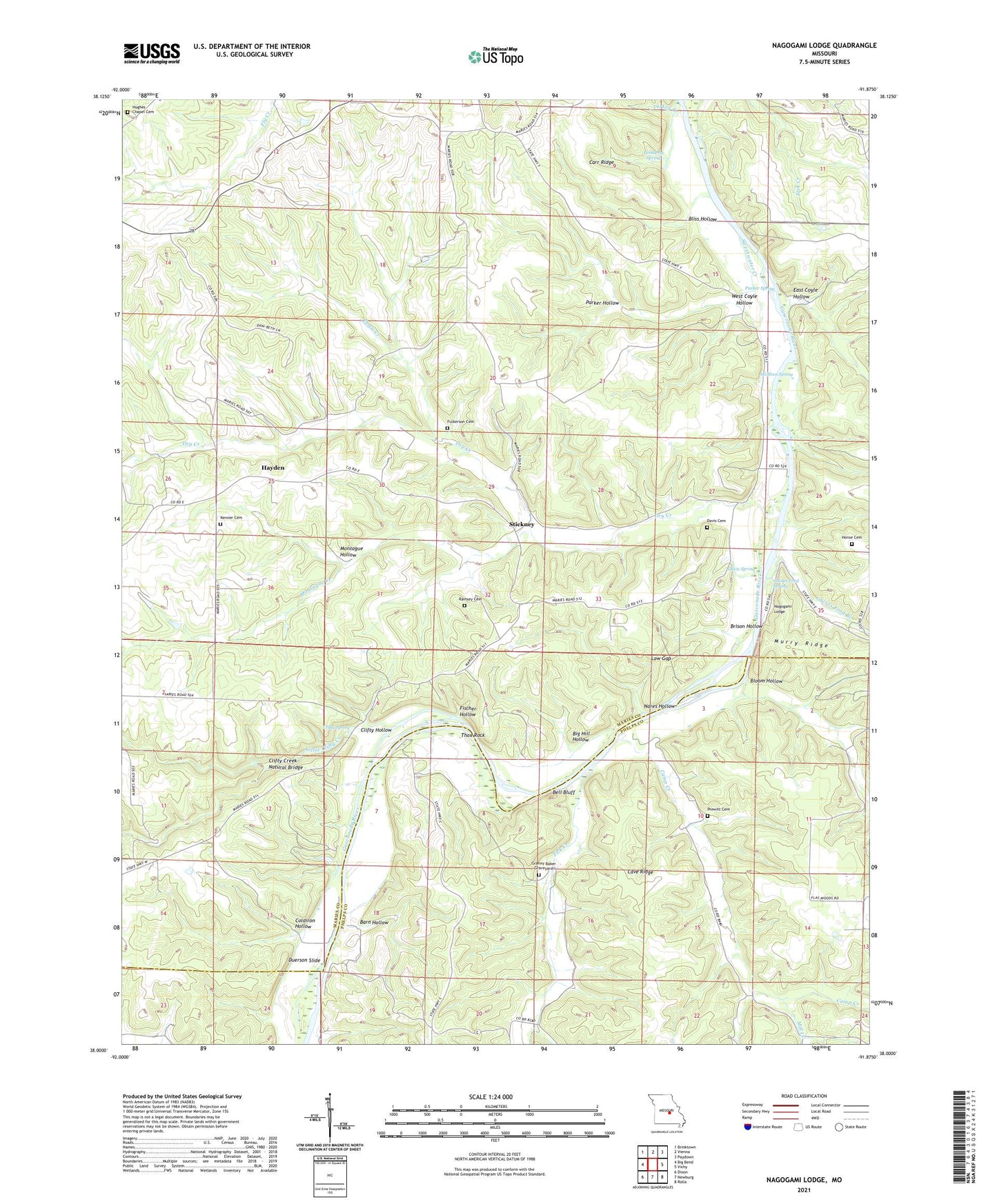
2021 topographic map quadrangle Nagogami Lodge in the state of Missouri. Scale: 1:24000. Based on the newly updated USGS 7.5' US Topo map series, this map is in the following counties: Maries, Phelps. The map contains contour data, water features, and other items you are used to seeing on USGS maps, but also has updated roads and other features. This is the next generation of topographic maps. Printed on high-quality waterproof paper with UV fade-resistant inks.
Quads adjacent to this one:
West: Big Bend
Northwest: Brinktown
North: Vienna
Northeast: Paydown
East: Vichy
Southeast: Rolla
South: Newburg
Southwest: Dixon
This map covers the same area as the classic USGS quad with code o38091a8.
Contains the following named places: Apex Lake Dam, Barn Hollow, Bell Bluff, Bell Chute Public Access, Bell School, Big Hill Hollow, Bliss Hollow, Bloom Hollow, Brison Hollow, Camp Creek, Carr Ridge, Cave Ridge, Clifty Creek Natural Bridge, Clifty Hollow, Clifty Spring, Coldiron Hollow, Davis Cemetery, Davis Spring, Doyle Creek, Dry Creek, Duerson Slide, East Coyle Hollow, Fischer Hollow, Fulkerson Cemetery, Gaines Ferry, Gaines Ford, Gaines Ford Branch, Gaines Ford Spring, Granny Baker Graveyard, Hayden, Honse Cemetery, Hughes Chapel, Hughes Chapel School, Kenner Church, Kenner School, Koch Lake Dam, Little Clifty Creek, Low Gap, McMinn School, McMinn Spring, Mill Creek, Miller Lake Dam, Montague Creek, Montague Hollow, Nagogami Lodge, Nares Hollow, Parker Hollow, Parker Spring, Pemberty Spring, Prewett School, Prewitt Cemetery, Ramsey Cemetery, Spencer Store, Stickney, Sweetwater Creek, Thox Rock, Tick Creek, Township of Dry Creek, Turkey Creek, West Coyle Hollow, Wilson Lake Dam