MyTopo
Shackleford Missouri US Topo Map
Couldn't load pickup availability
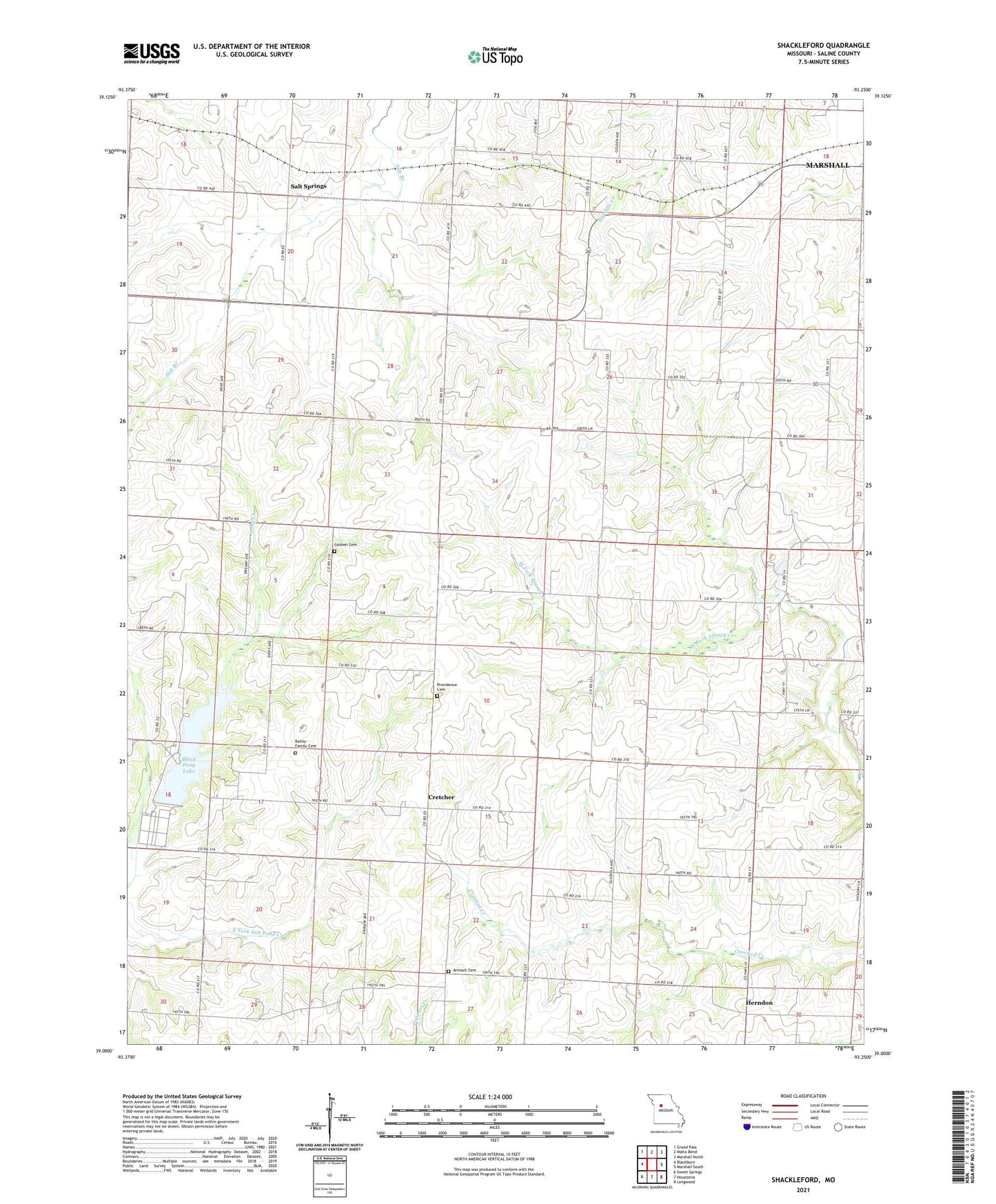
2021 topographic map quadrangle Shackleford in the state of Missouri. Scale: 1:24000. Based on the newly updated USGS 7.5' US Topo map series, this map is in the following counties: Saline. The map contains contour data, water features, and other items you are used to seeing on USGS maps, but also has updated roads and other features. This is the next generation of topographic maps. Printed on high-quality waterproof paper with UV fade-resistant inks.
Quads adjacent to this one:
West: Blackburn
Northwest: Grand Pass
North: Malta Bend
Northeast: Marshall North
East: Marshall South
Southeast: Longwood
South: Houstonia
Southwest: Sweet Springs
This map covers the same area as the classic USGS quad with code o39093a3.
Contains the following named places: Antioch Church, Antioch School, Blind Pony Lake, Blind Pony Lake Dam, Blind Pony Wildlife Area, Cretcher, Elm Grove School, Fulkerson School, Goshen Cemetery, Green Mound School, Hazel Grove Church, Herndon, Herndon School, Miller School, Providence Cemetery, Salt Springs, Shackleford, South Grove School, Stonewall School, Sunny Side School