MyTopo
Bolckow Missouri US Topo Map
Couldn't load pickup availability
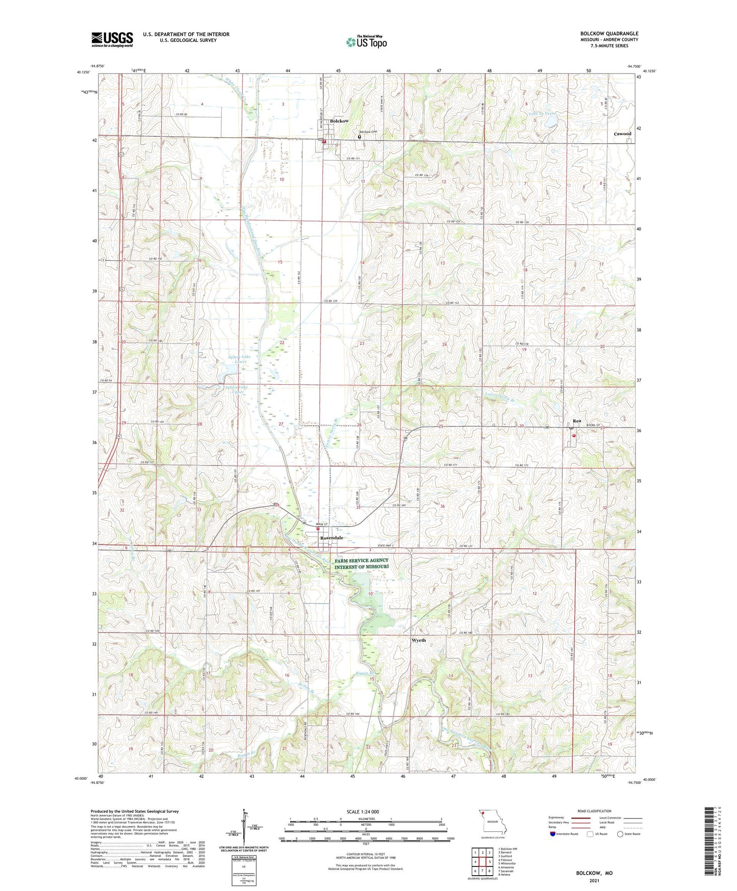
2021 topographic map quadrangle Bolckow in the state of Missouri. Scale: 1:24000. Based on the newly updated USGS 7.5' US Topo map series, this map is in the following counties: Andrew. The map contains contour data, water features, and other items you are used to seeing on USGS maps, but also has updated roads and other features. This is the next generation of topographic maps. Printed on high-quality waterproof paper with UV fade-resistant inks.
Quads adjacent to this one:
West: Fillmore
Northwest: Bolckow NW
North: Barnard
Northeast: Guilford
East: Whitesville
Southeast: Helena
South: Savannah
Southwest: Amazonia
This map covers the same area as the classic USGS quad with code o40094a7.
Contains the following named places: Bolckow, Bolckow Cemetery, Bolckow Fire Protection District, Bolckow Post Office, City of Bolckow, City of Rea, City of Rosendale, Eva Neely Davis Memorial State Forest, Fairview Church, Glenwood School, Hadorn Bridge Access Area, Hickory Point School, Housman School, Kellog Branch, Lake La Verne, Lake La Verne Dam, Lower Neely Branch, Lower Neely School, Midway, Montgomery School, Mount Calvary School, Oak Grove School, Parker School, Radical School, Rea, Rea Post Office, Riggin Branch, Rosendale, Rosendale Fire Protection District Station 1, Rosendale Fire Protection District Station 2, Rosendale Post Office, Sybert Lake - Lower, Sybert Lake - Upper, Sybert Lake Dam - Lower, Sybert Lake Dam - Upper, Township of Benton, Upper Neely Branch, Upper Neely School, Vernon Church, White Cloud Creek, Wyeth, ZIP Codes: 64427, 64483