MyTopo
Bolivar Missouri US Topo Map
Couldn't load pickup availability
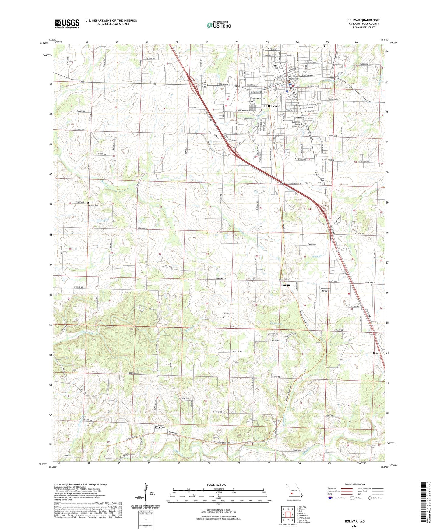
2021 topographic map quadrangle Bolivar in the state of Missouri. Scale: 1:24000. Based on the newly updated USGS 7.5' US Topo map series, this map is in the following counties: Polk. The map contains contour data, water features, and other items you are used to seeing on USGS maps, but also has updated roads and other features. This is the next generation of topographic maps. Printed on high-quality waterproof paper with UV fade-resistant inks.
Quads adjacent to this one:
West: Aldrich
Northwest: Fair Play
North: Cliquot
Northeast: Polk
East: Cedar Vista
Southeast: Pleasant Hope
South: Morrisville
Southwest: Walnut Grove
This map covers the same area as the classic USGS quad with code o37093e4.
Contains the following named places: Bolivar, Bolivar Fire Department Station 1, Bolivar Fire Department Station 2, Bolivar Memorial Airport, Bolivar Police Department, Bolivar Post Office, Campbell Grove Church, Central Polk County Fire and Rescue, Cherokee Airpark, City Cemetery, City of Bolivar, Collins School, Department of Conservation Southwest Field Fire Facility Bolivar, Elm Grove School, Enon Church, Forest Grove School, Greenwood Cemetery, Hensley Cemetery, Hickory Point Church, Hickory Point School, Independence School, Karlin, KYOO-FM (Bolivar), Morrisville, Morrisville Fire and Rescue Station 3, North Ward School, Oak Grove School, Pleasant Vale School, Polk County, Polk County Sheriff's Office, Runyan School, Slagle, South Ward School, Southwest Baptist University, Spencer Cemetery, Tommie Creek, Township of Southwest Marion, Township of Wishart, Wishart