MyTopo
Cliquot Missouri US Topo Map
Couldn't load pickup availability
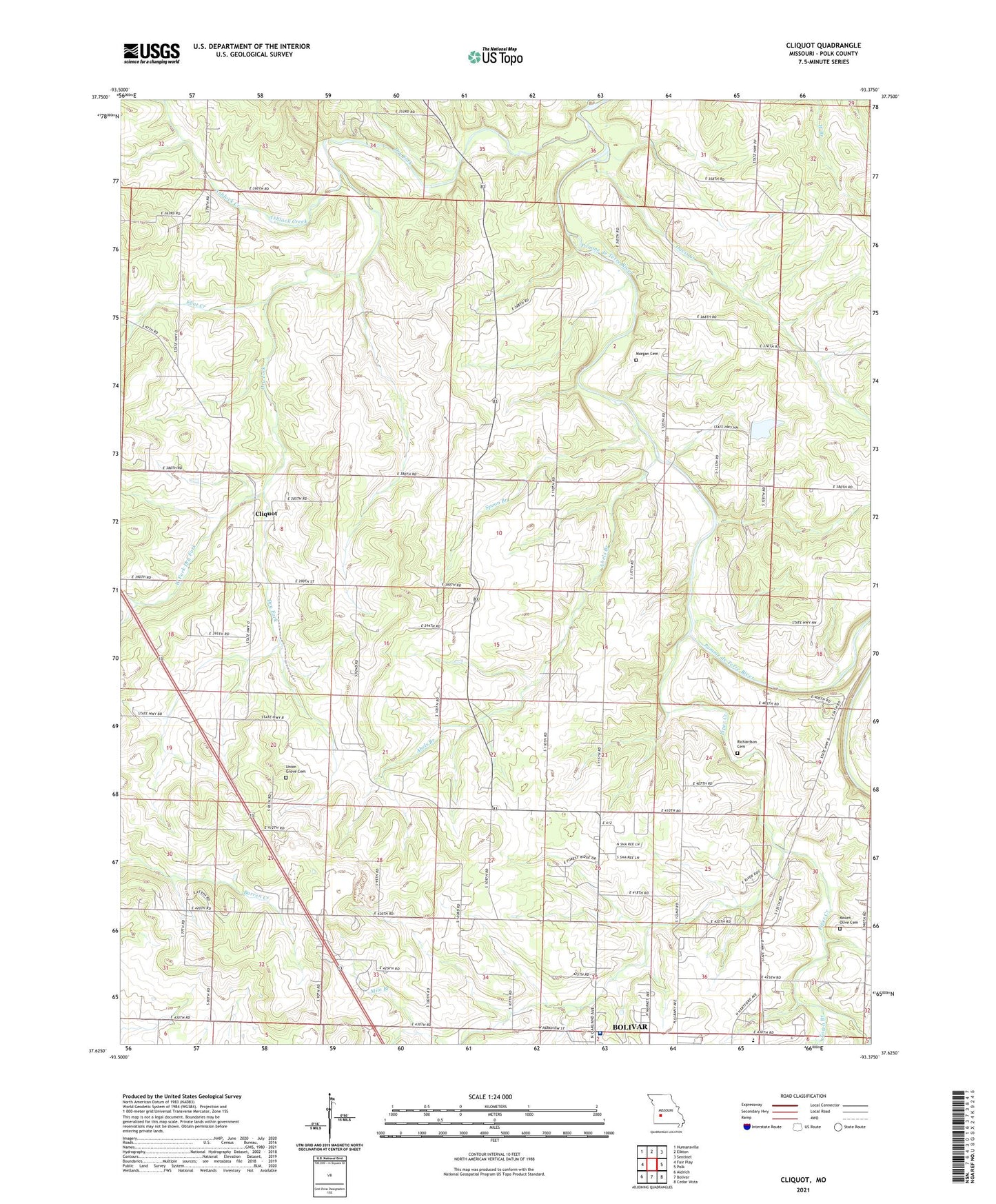
2021 topographic map quadrangle Cliquot in the state of Missouri. Scale: 1:24000. Based on the newly updated USGS 7.5' US Topo map series, this map is in the following counties: Polk. The map contains contour data, water features, and other items you are used to seeing on USGS maps, but also has updated roads and other features. This is the next generation of topographic maps. Printed on high-quality waterproof paper with UV fade-resistant inks.
Quads adjacent to this one:
West: Fair Play
Northwest: Humansville
North: Elkton
Northeast: Sentinel
East: Polk
Southeast: Cedar Vista
South: Bolivar
Southwest: Aldrich
This map covers the same area as the classic USGS quad with code o37093f4.
Contains the following named places: Abels Branch, Ashlock Creek, Citizens Memorial Hospital, Cliquot, Cliquot School, Cooper School, Davis Creek, Dry Fork, Dunnegan Park, Flint Creek, Flint School, Harmony Church, Heydon School, KYOO-AM (Bolivar), Liberty School, Mile Branch, Moore School, Morgan Cemetery, Mount Etna School, Mount Olive Cemetery, Mount Olive Church, Ozark School, Piper Creek, Richardson Cemetery, Salem Church, Spoon Branch, Town Branch, Township of Cliquot, Township of Northwest Marion, Union Grove Cemetery, Union Grove School, Watson School, West Fork Dry Fork, West Union School, Woods Lake Dam, ZIP Code: 65613