MyTopo
Polk Missouri US Topo Map
Couldn't load pickup availability
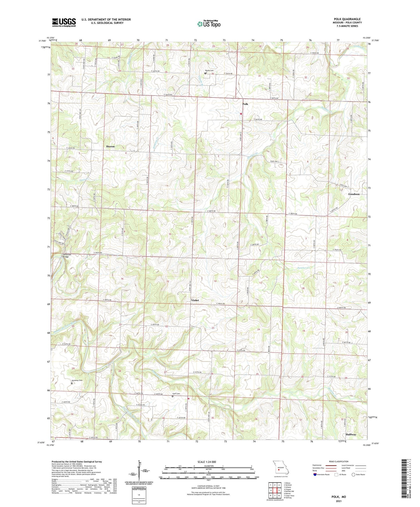
2021 topographic map quadrangle Polk in the state of Missouri. Scale: 1:24000. Based on the newly updated USGS 7.5' US Topo map series, this map is in the following counties: Polk. The map contains contour data, water features, and other items you are used to seeing on USGS maps, but also has updated roads and other features. This is the next generation of topographic maps. Printed on high-quality waterproof paper with UV fade-resistant inks.
Quads adjacent to this one:
West: Cliquot
Northwest: Elkton
North: Sentinel
Northeast: Urbana
East: Buffalo NW
Southeast: Halfway
South: Cedar Vista
Southwest: Bolivar
This map covers the same area as the classic USGS quad with code o37093f3.
Contains the following named places: Black Oak School, Clark School, Dewey, Dunaway Cemetery, Eidson School, Emma D School, Goff Cemetery, Goodson, Gordon Lake Dam, Green Leaf School, Green Mound School, Halfway Volunteer Fire Department Station 3, Hominy Creek, Huron, Huron Church, Jefferson Bridge, Ozark School, Panther Creek, Payne Cemetery, Polk, Polk County Post Office, Polk Rural Fire Department, Roberts School, Spring Valley Church, Township of McKinley, Township of North Benton, Township of Northeast Marion, Union Ridge School, Union School, Violet, Warren Lake Dam