MyTopo
Bonne Terre Missouri US Topo Map
Couldn't load pickup availability
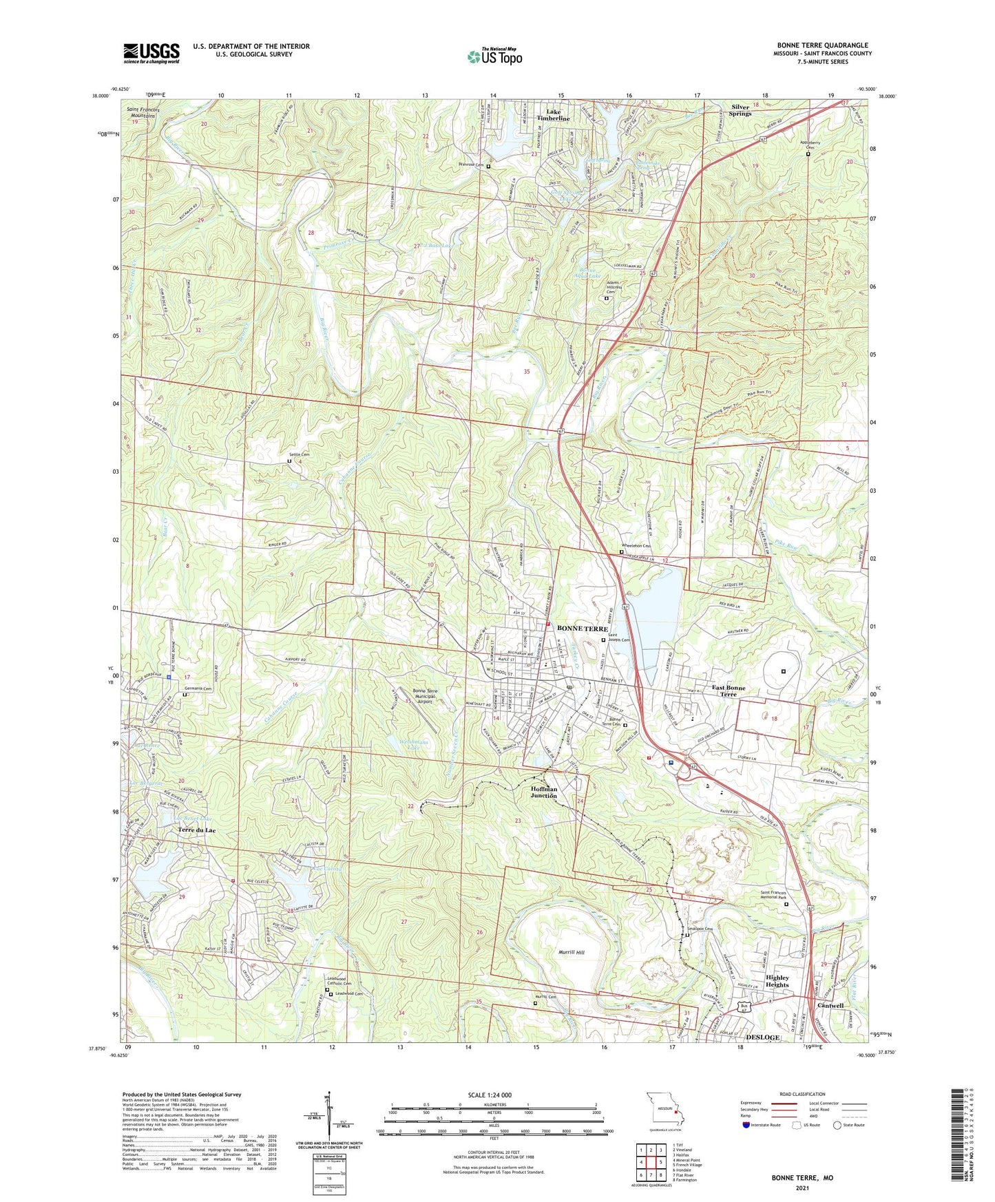
2021 topographic map quadrangle Bonne Terre in the state of Missouri. Scale: 1:24000. Based on the newly updated USGS 7.5' US Topo map series, this map is in the following counties: St. Francois. The map contains contour data, water features, and other items you are used to seeing on USGS maps, but also has updated roads and other features. This is the next generation of topographic maps. Printed on high-quality waterproof paper with UV fade-resistant inks.
Quads adjacent to this one:
West: Mineral Point
Northwest: Tiff
North: Vineland
Northeast: Halifax
East: French Village
Southeast: Farmington
South: Flat River
Southwest: Irondale
Contains the following named places: Adams - Hillcrest Cemetery, Appleberry Cemetery, Bear Creek, Bee Run, Bee Run Lake Number 1 Dam, Bee Run Lake Number 2 Dam, Bee Run Lake Number 3 Dam, Big River Fire Protection District Station 1, Big River Mills School, Bonne Aqua Lake, Bonne Aqua Lake Dam, Bonne Terre, Bonne Terre Fire Department, Bonne Terre Municipal Airport, Bonne Terre Police Department, Bonne Terre Post Office, Cabanne Course, Cedar Lake, Cedar Lake Dam, City of Bonne Terre, City of Desloge, Coonville Creek, Coonville School, Dolomite Mines, East Bonne Terre, Eastern Reception Diagnostic and Correctional Center, Germania Cemetery, Germania School, Goff Spring, Goff Spring Lake, Goff Springs Dam, Highley Heights, Hoffman Junction, La Grave Mines, Lac Benet Dam, Lac Benet Lake, Lac Calista, Lac Calista Dam, Lac Emerald, Lac Emerald Dam, Lac Lafitte Dam, Lac Marseilles, Lac Marseilles Dam, Lac Renee, Lac Renee Dam, Lake Primrose, Lake Primrose Dam, Lake Timberline, Lake Timberline Census Designated Place, Lake Timberline Dam, Lakeview Park Dam, Lakeview Park Lake, Lead Belt Technical School, Leadwood Cemetery, Manchester Lead Diggings, McDowell Lake Dam, Murrill Cemetery, Murrill Hill, Number Seven Creek, P J Bass Lake, P J Bass Lake Dam, Parkland Health Medical Center - Bonne Terre, Pike Run, Pleasant Mount School, Primrose Creek, Primrose School, Primrose Temperance Missionary Baptist Church, Providence Church, Rattlesnake Spring, Saint Francois Memorial Park, Saint Francois State Park, Saint Joseph Cemetery, Settle Cemetery, Settletown, Silver Springs, Silver Springs Church, Smallpox Cemetery, Terre Bleue Creek, Terre du Lac Census Designated Place, Terre Du Lac Fire Department Station 2, Terre Du Lac Police Department, The Lead Belt, Three Hill Creek, Township of Big River, Township of Perry, Turkey Creek, Welshmans Lake, Welshmans Lake Dam, ZIP Code: 63628