MyTopo
Halifax Missouri US Topo Map
Couldn't load pickup availability
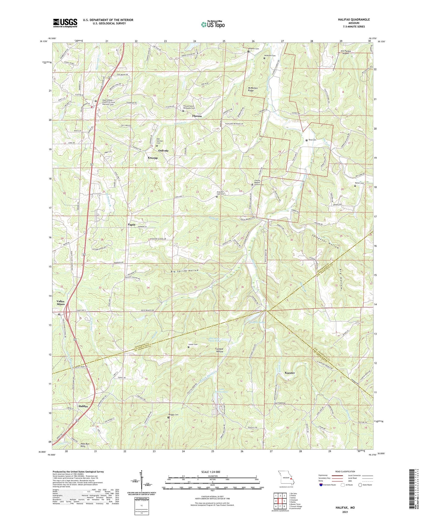
2021 topographic map quadrangle Halifax in the state of Missouri. Scale: 1:24000. Based on the newly updated USGS 7.5' US Topo map series, this map is in the following counties: Jefferson, St. Francois, Ste. Genevieve. The map contains contour data, water features, and other items you are used to seeing on USGS maps, but also has updated roads and other features. This is the next generation of topographic maps. Printed on high-quality waterproof paper with UV fade-resistant inks.
Quads adjacent to this one:
West: Vineland
Northwest: De Soto
North: Festus
Northeast: Selma
East: Danby
Southeast: Lawrenceton
South: French Village
Southwest: Bonne Terre
This map covers the same area as the classic USGS quad with code o38090a4.
Contains the following named places: Acquilla Cole Cemetery, Aire Parque Airport, Armbruster School, Athena R 8 School, Avoca School, Barbin Branch, Big Hollow, Big Spring Hollow, Boyd Branch, Byrd Cemetery, Charter Church, De Soto Rural Fire Protection District Station 4, Dry Fork, Finney Creek, Flucom, Fulcom School, Furnace Hollow, German Church, Halifax, Harmans Farm Pond Dam, Harmons Farm Pond, High Ridge School, Hope United Church of Christ Ebenezer Cemetery, Knorpp, Koester, Koester School, Laguna Palma, Laguna Palma Dam, Lake Lacawanna, Lake Lacawanna Dam, Lester Cemetery, McMullen Cemetery, McMullen Ridge, McMullen School, Oakvale, Old German Cemetery, Papin, Pfmester School, Porter Cemetery, Rocky Branch, Rouggly Cemetery, Rouggly Church, Rugley School, Saltpeter Hollow, Saltpeter School, Township of Plattin, Valles Mines, Valles Mines Creek, Valles Mines Post Office, West Fork Plattin Creek, Wheeler Cemetery, Wildwood Lake, ZIP Code: 63087