MyTopo
Bragg City Missouri US Topo Map
Couldn't load pickup availability
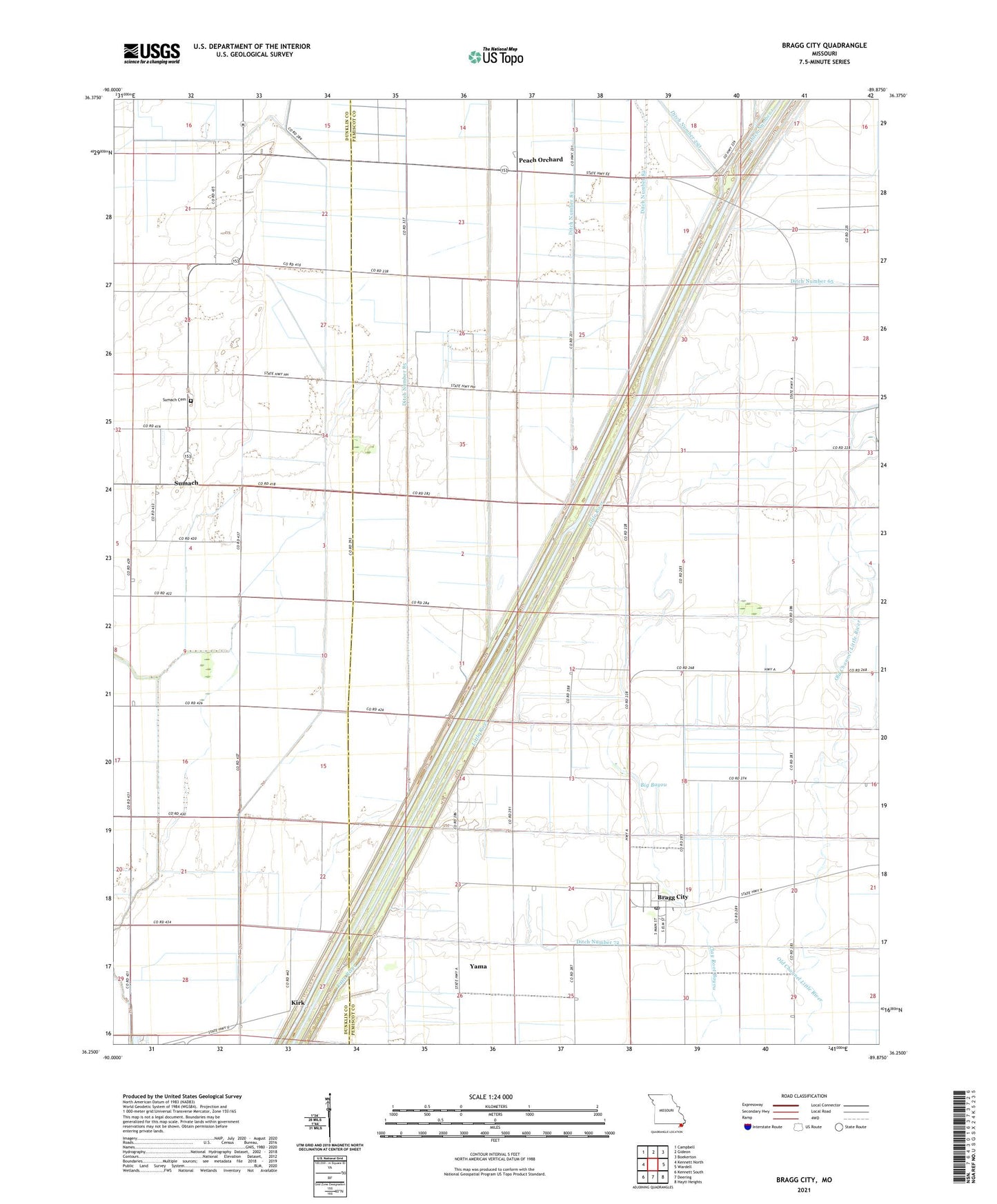
2021 topographic map quadrangle Bragg City in the state of Missouri. Scale: 1:24000. Based on the newly updated USGS 7.5' US Topo map series, this map is in the following counties: Pemiscot, Dunklin. The map contains contour data, water features, and other items you are used to seeing on USGS maps, but also has updated roads and other features. This is the next generation of topographic maps. Printed on high-quality waterproof paper with UV fade-resistant inks.
Quads adjacent to this one:
West: Kennett North
Northwest: Campbell
North: Gideon
Northeast: Boekerton
East: Wardell
Southeast: Hayti Heights
South: Deering
Southwest: Kennett South
This map covers the same area as the classic USGS quad with code o36089c8.
Contains the following named places: Big Bayou, Bragg City, Bragg City Post Office, Bragg City Volunteer Fire Department, Ditch Number 251, Ditch Number 65, Ditch Number 71, Ditch Number 72, Ditch Number 82, Ditch Number 83, Ditch Number 84, Ditch Number 85, Ford Chapel, Gidson, Gregory School, Grey Horse Lake, Kirk, Main Ditch Number 36, Nelson School, Nilo School, North Island School, Ogden, Peach Orchard, Penhook School, Richland School, Simpson School, Sumach, Sumach Cemetery, Sumach Church, Sumach School, Sumack Branch School, Tatum Chapel, Tatum School, The Floodway, Town of Bragg City, Township of Pascola, Yama, Yama School, ZIP Code: 63827