MyTopo
Wardell Missouri US Topo Map
Couldn't load pickup availability
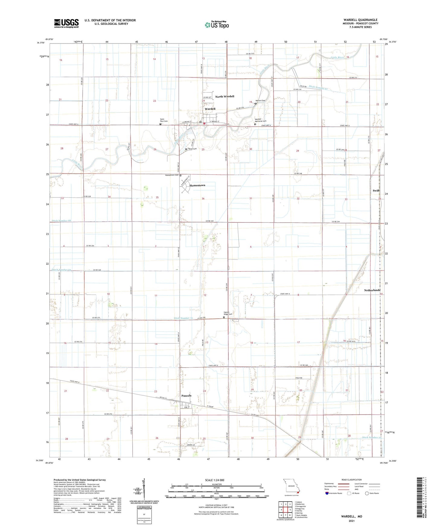
2021 topographic map quadrangle Wardell in the state of Missouri. Scale: 1:24000. Based on the newly updated USGS 7.5' US Topo map series, this map is in the following counties: Pemiscot. The map contains contour data, water features, and other items you are used to seeing on USGS maps, but also has updated roads and other features. This is the next generation of topographic maps. Printed on high-quality waterproof paper with UV fade-resistant inks.
Quads adjacent to this one:
West: Bragg City
Northwest: Gideon
North: Boekerton
Northeast: Portageville
East: Stanley
Southeast: Caruthersville
South: Hayti Heights
Southwest: Deering
This map covers the same area as the classic USGS quad with code o36089c7.
Contains the following named places: City of Homestown, Ditch Number 22, Ditch Number 25, Ditch Number 295, Ditch Number 64, Ditch Number 67, Ditch Number 68, Ditch Number 69, Ditch Number 70, Ewells, Hodgens School, Homestown, Ingram Ridge, Ingram Ridge Cemetery, Ingram Ridge Church, James, Keokuk, Netherlands, North Wardell, Pascola, Pin Oak School, Rowe Cemetery, Saint Paul Cemetery, Saint Paul Church, Swift, Terry, Town of Wardell, Township of Little River, Village of North Wardell, Village of Pascola, Wardell, Wardell Memorial Cemetery, Wardell Police Department, Wardell Post Office, Wardell Volunteer Fire Department, Warren Cemetery, Wilbur, ZIP Code: 63879