MyTopo
Boekerton Missouri US Topo Map
Couldn't load pickup availability
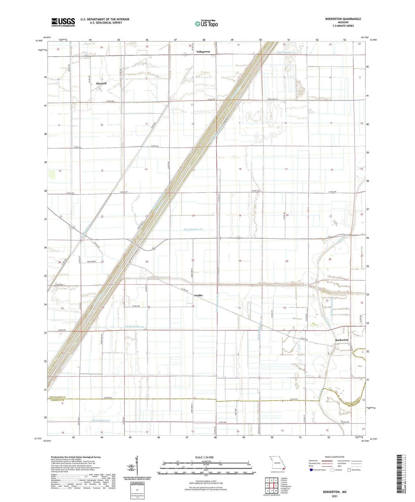
2021 topographic map quadrangle Boekerton in the state of Missouri. Scale: 1:24000. Based on the newly updated USGS 7.5' US Topo map series, this map is in the following counties: New Madrid, Pemiscot. The map contains contour data, water features, and other items you are used to seeing on USGS maps, but also has updated roads and other features. This is the next generation of topographic maps. Printed on high-quality waterproof paper with UV fade-resistant inks.
Quads adjacent to this one:
West: Gideon
Northwest: Malden
North: Parma
Northeast: Catron
East: Portageville
Southeast: Stanley
South: Wardell
Southwest: Bragg City
This map covers the same area as the classic USGS quad with code o36089d7.
Contains the following named places: Boekerton, Cottrell School, Ditch Number 1, Ditch Number 256, Ditch Number 290, Ditch Number 55, Ditch Number 55-A, Ditch Number 56, Ditch Number 57, Ditch Number 59, Ditch Number 60, Ditch Number 61, Ditch Number 62, Ditch Number 63, Ditch Number 8, Ditch Number 9, Flagland School, Floodway School, Frailie, Frailie School, Garver, Hartzell, Hildreth Church, Hildreth School, Hill School, Huie Church, Lateral School, New Garver, Portage Open Bay, Township of Portage