MyTopo
Brinktown Missouri US Topo Map
Couldn't load pickup availability
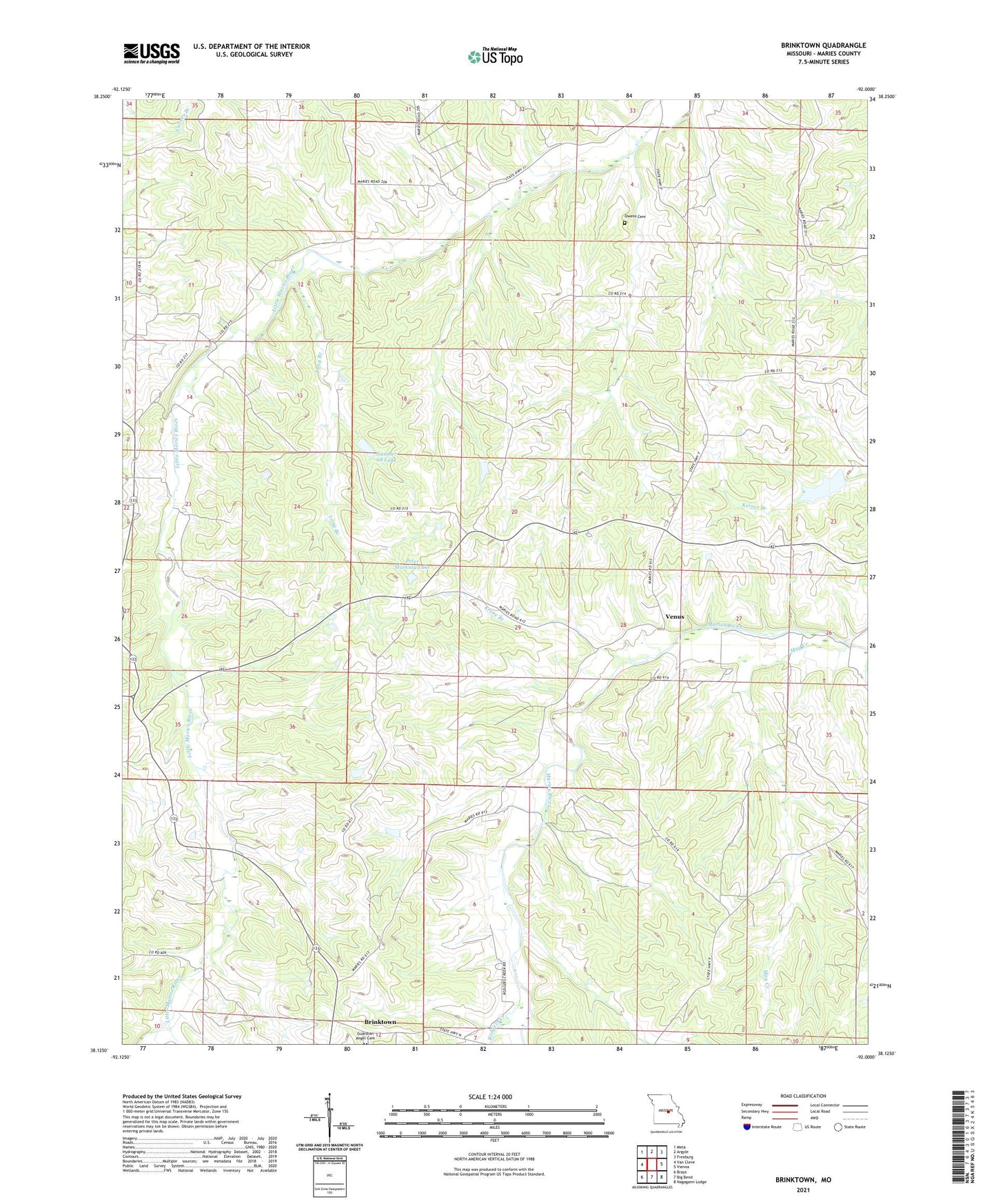
2021 topographic map quadrangle Brinktown in the state of Missouri. Scale: 1:24000. Based on the newly updated USGS 7.5' US Topo map series, this map is in the following counties: Maries. The map contains contour data, water features, and other items you are used to seeing on USGS maps, but also has updated roads and other features. This is the next generation of topographic maps. Printed on high-quality waterproof paper with UV fade-resistant inks.
Quads adjacent to this one:
West: Van Cleve
Northwest: Meta
North: Argyle
Northeast: Freeburg
East: Vienna
Southeast: Nagogami Lodge
South: Big Bend
Southwest: Brays
Contains the following named places: Blake Lake Dam, Brinktown, Burns School, Cairns, Charwood Lake, Danube Corporation Lower Dam, Danube Corporation Upper Dam, Enterprise School, Flat Top School, Guardian Angel Cemetery, Hoban Lake Dam, Kleffner Lake Dam, Krone Branch, Lambeth School, Long Branch, Mag Creek, Nepomuceno Lake Dam, Number 68 Lake, Ozark Junction, Peter Markuly Lake, Prosperity School, Rodgers Creek, Township of Boone, Venus, Wiles School, Wilson Lake Dam, ZIP Code: 65443