MyTopo
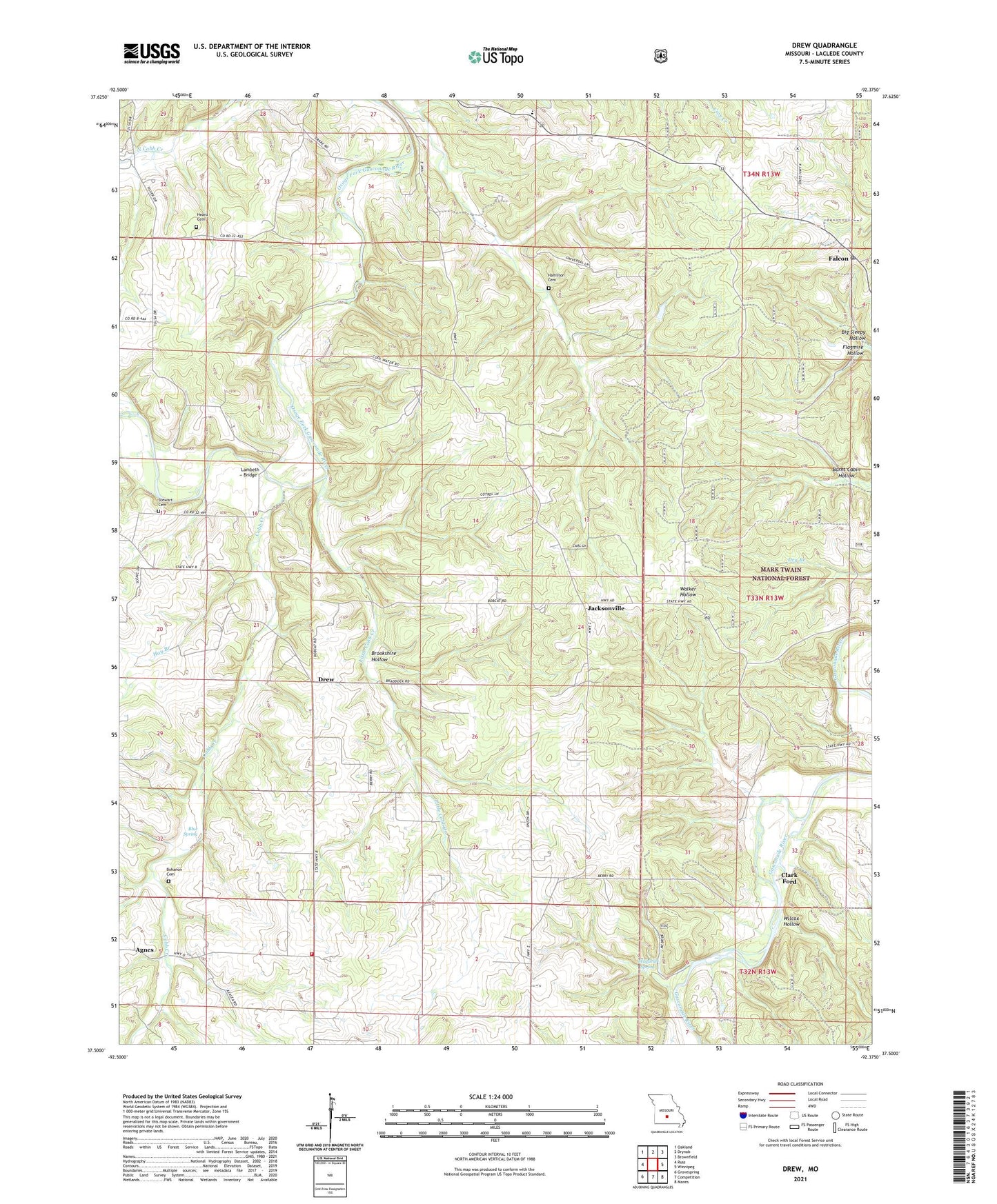
Drew Missouri US Topo Map
Couldn't load pickup availability
Also explore the Drew Forest Service Topo of this same quad for updated USFS data
2021 topographic map quadrangle Drew in the state of Missouri. Scale: 1:24000. Based on the newly updated USGS 7.5' US Topo map series, this map is in the following counties: Laclede. The map contains contour data, water features, and other items you are used to seeing on USGS maps, but also has updated roads and other features. This is the next generation of topographic maps. Printed on high-quality waterproof paper with UV fade-resistant inks.
Quads adjacent to this one:
West: Russ
Northwest: Oakland
North: Drynob
Northeast: Brownfield
East: Winnipeg
Southeast: Manes
South: Competition
Southwest: Grovespring
This map covers the same area as the classic USGS quad with code o37092e4.
Contains the following named places: Agnes, Barnett School, Bee Branch, Big Sleepy Hollow, Blue Spring, Bohanon Cemetery, Brookshire Hollow, Burnt Cabin Hollow, Clark Ford, Cobb Creek, Competition Volunteer Fire Department Station 1, Delto School, Drew, Fairnob School, Falcon, Falcon Church, Falcon Post Office, Flagmire Hollow, Franklin School, Hamilton Cemetery, Harmony Church, Harmony School, Hay Branch, Heard Cemetery, Heard School, Jacksonville, Lambeth Bridge, Little Cobb Creek, Lyons, Mayfield Spring, Moots Store, Morris Lake Dam, New Home Church, Nurse School, Porter Chapel, Stewart Cemetery, Township of Franklin, Wilcox Hollow, Winter Store, ZIP Code: 65470