MyTopo
Burksville Missouri US Topo Map
Couldn't load pickup availability
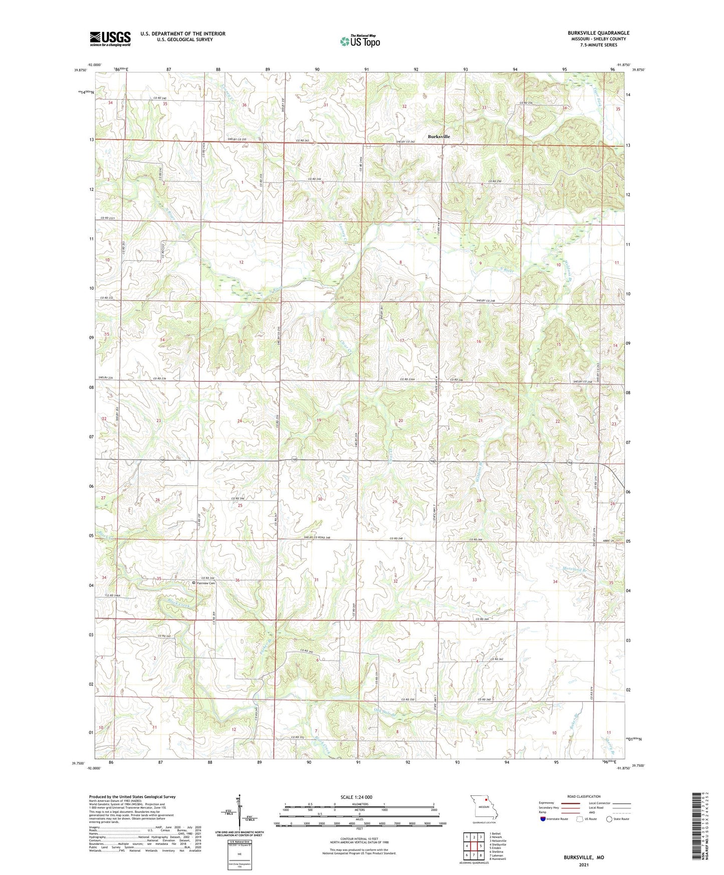
2021 topographic map quadrangle Burksville in the state of Missouri. Scale: 1:24000. Based on the newly updated USGS 7.5' US Topo map series, this map is in the following counties: Shelby. The map contains contour data, water features, and other items you are used to seeing on USGS maps, but also has updated roads and other features. This is the next generation of topographic maps. Printed on high-quality waterproof paper with UV fade-resistant inks.
Quads adjacent to this one:
West: Shelbyville
Northwest: Bethel
North: Newark
Northeast: Nelsonville
East: Emden
Southeast: Hunnewell
South: Lakenan
Southwest: Shelbina
Contains the following named places: Baker School, Bethany Church, Burksville, Clear Creek, Fairview Cemetery, Frye School, Gooch School, Looney Creek, Mount Zion Baptist Church, Nesbit School, Oak Dale Branch, Oak Dale Church, Oak Dell School, Oakdale, Old Brick Church, Parker Branch, Prairie View School, Rex Gard Lake, Valley Grove School, Vannoy East Lake Dam, Vannoy West Lake Dam, Weedon School, Weldons Branch, Wiseman Lake Dam