MyTopo
Lakenan Missouri US Topo Map
Couldn't load pickup availability
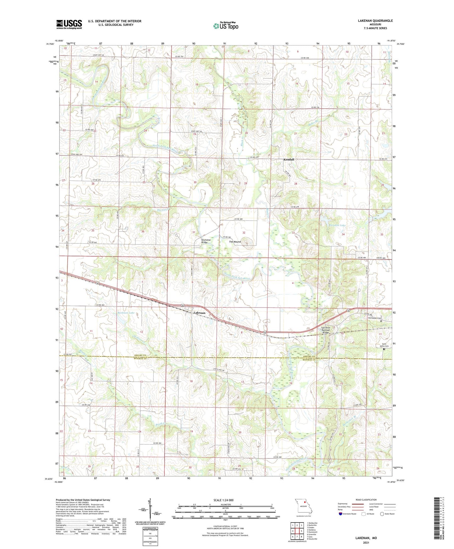
2021 topographic map quadrangle Lakenan in the state of Missouri. Scale: 1:24000. Based on the newly updated USGS 7.5' US Topo map series, this map is in the following counties: Shelby, Monroe. The map contains contour data, water features, and other items you are used to seeing on USGS maps, but also has updated roads and other features. This is the next generation of topographic maps. Printed on high-quality waterproof paper with UV fade-resistant inks.
Quads adjacent to this one:
West: Shelbina
Northwest: Shelbyville
North: Burksville
Northeast: Emden
East: Hunnewell
Southeast: Stoutsville
South: Goss
Southwest: Granville
This map covers the same area as the classic USGS quad with code o39091f8.
Contains the following named places: Baker Branch, Beatley School, Black Creek, Buckman Dam, Buckman Lake, Cox School, Givan School, Graham School, Greenwell School, Hightower School, Horseshoe Branch, Hunnewell Cemetery, Jackson Creek, Kendall, Kincheloe Bridge, Lakenan, Paradise Lake, Prairie View Church, Saint Johns Cemetery, Saint Roses Catholic Church, Salt River Railroad Bridge, Simmons Lake Dam, Smith Lake Dam, The Mound, Thomas Creek, Township of Jackson, ZIP Code: 63443