MyTopo
Hunnewell Missouri US Topo Map
Couldn't load pickup availability
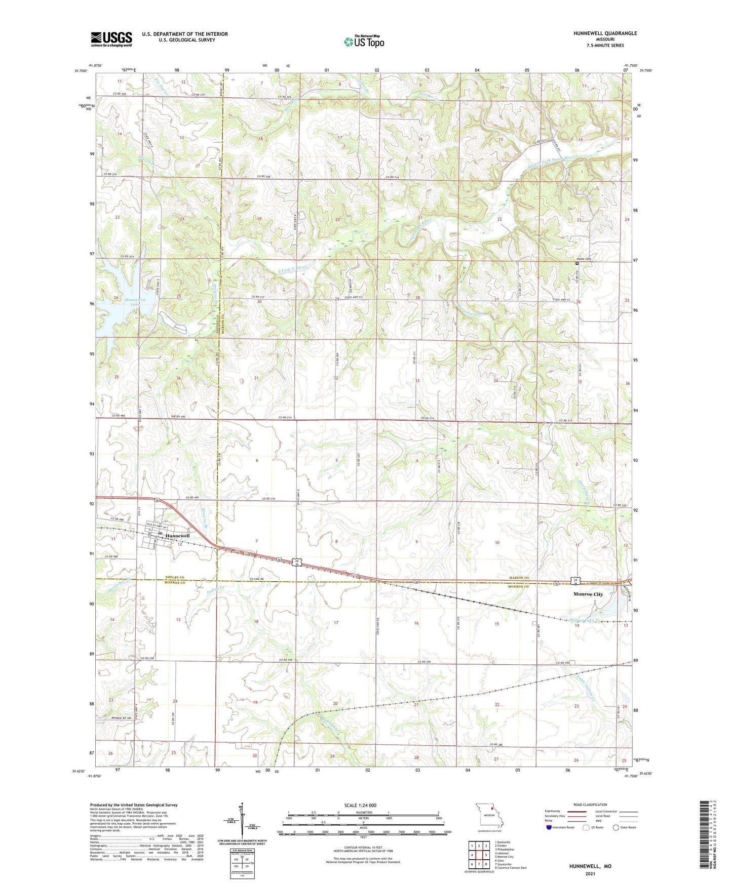
2021 topographic map quadrangle Hunnewell in the state of Missouri. Scale: 1:24000. Based on the newly updated USGS 7.5' US Topo map series, this map is in the following counties: Marion, Monroe, Shelby. The map contains contour data, water features, and other items you are used to seeing on USGS maps, but also has updated roads and other features. This is the next generation of topographic maps. Printed on high-quality waterproof paper with UV fade-resistant inks.
Quads adjacent to this one:
West: Lakenan
Northwest: Burksville
North: Emden
Northeast: Philadelphia
East: Monroe City
Southeast: Clarence Cannon Dam
South: Stoutsville
Southwest: Goss
This map covers the same area as the classic USGS quad with code o39091f7.
Contains the following named places: Barr School, Browne Branch, Buckman School, City of Hunnewell, City of Monroe Dam A, Colored School, Cooper School, Deer Lick, Hickory Hill School, Howe Cemetery, Hunnewell, Hunnewell Lake, Hunnewell Lake Dam, Hunnewell Post Office, Hunnewell Wildlife Management Area, Jones Branch, Lyell Airport, Monroe Lake A, Pee Dee Creek, Sharpsburg, Sharpsburg Baptist Church, Sharpsburg Branch, Sherry Branch, Union Chapel, Union Chapel School