MyTopo
Butler Missouri US Topo Map
Couldn't load pickup availability
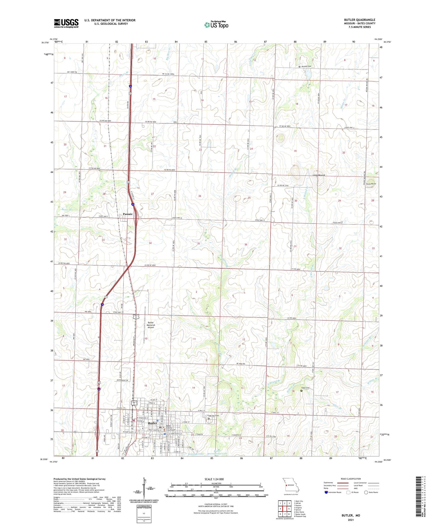
2021 topographic map quadrangle Butler in the state of Missouri. Scale: 1:24000. Based on the newly updated USGS 7.5' US Topo map series, this map is in the following counties: Bates. The map contains contour data, water features, and other items you are used to seeing on USGS maps, but also has updated roads and other features. This is the next generation of topographic maps. Printed on high-quality waterproof paper with UV fade-resistant inks.
Quads adjacent to this one:
West: Virginia
Northwest: Main City
North: Adrian
Northeast: Dayton
East: Spruce
Southeast: Pleasant Gap
South: Butler South
Southwest: New Home
This map covers the same area as the classic USGS quad with code o38094c3.
Contains the following named places: Bates County, Bates County Sheriff's Office, Bobcat Fork, Butler, Butler Academy, Butler Elementary School, Butler Fire Department, Butler High School, Butler Memorial Airport, Butler Police Department, Butler Post Office, Church of Christ, City of Butler, Collins Lake, Collins Lake Dam, Daisys Creek, Dillon School, East Mound Branch, Glass Branch, Glass Cemetery, Herrell School, Little Deer Creek School, Long Mound, Mount Olivet Church, Mount Zion School, Nichols Cemetery, Oak Hill Cemetery, Passaic, Passaic School, Patty School, Powell Lake, Powell Lake Dam, Round Mound, Seelinger Branch, Shady Dell School, Town of Passaic, Township of Mound, Township of Mount Pleasant, WeMott School, Westgate Shopping Center, Willow Branch, ZIP Code: 64730