MyTopo
Virginia Missouri US Topo Map
Couldn't load pickup availability
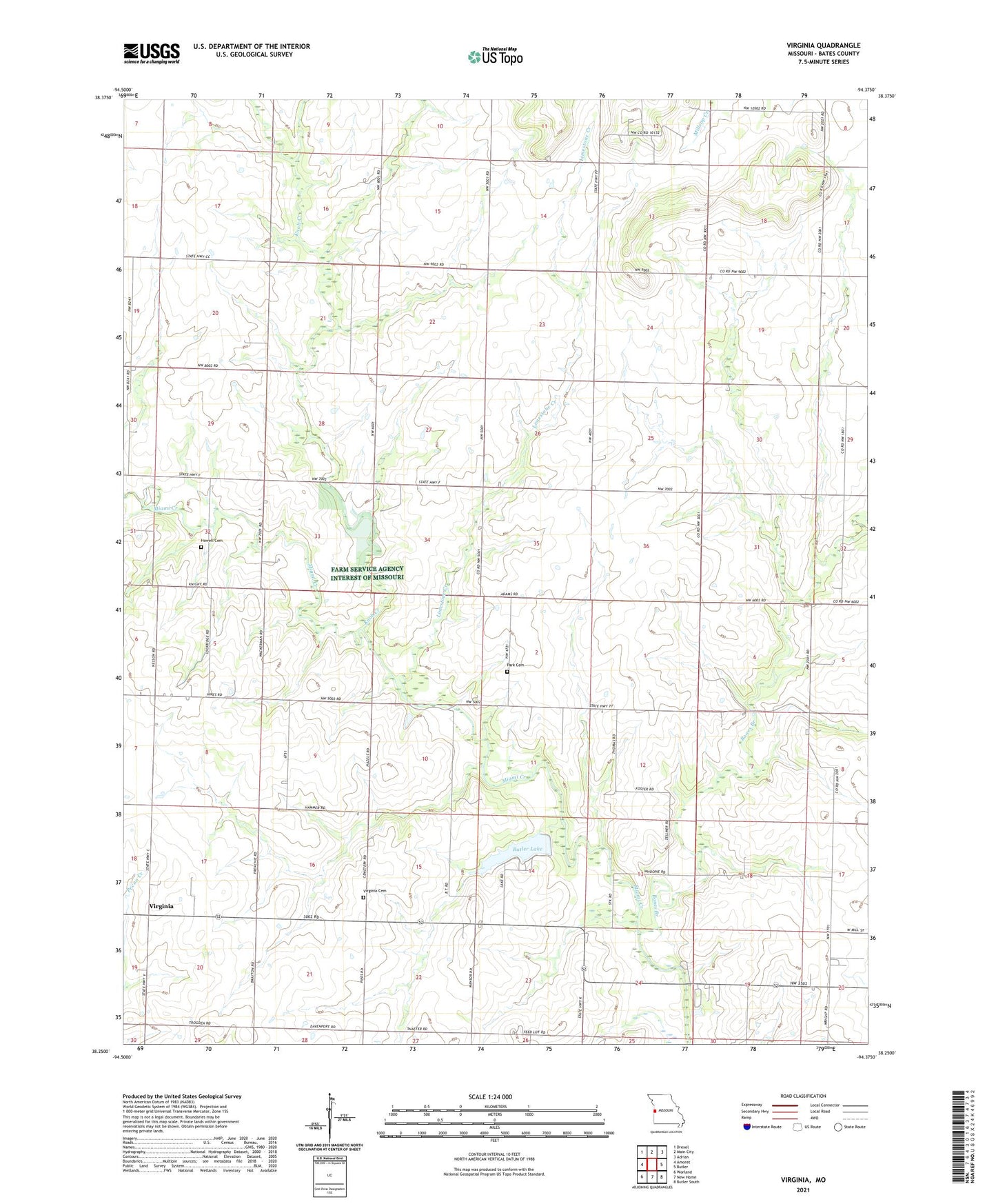
2021 topographic map quadrangle Virginia in the state of Missouri. Scale: 1:24000. Based on the newly updated USGS 7.5' US Topo map series, this map is in the following counties: Bates. The map contains contour data, water features, and other items you are used to seeing on USGS maps, but also has updated roads and other features. This is the next generation of topographic maps. Printed on high-quality waterproof paper with UV fade-resistant inks.
Quads adjacent to this one:
West: Amoret
Northwest: Drexel
North: Main City
Northeast: Adrian
East: Butler
Southeast: Butler South
South: New Home
Southwest: Worland
This map covers the same area as the classic USGS quad with code o38094c4.
Contains the following named places: Baptist Church, Bethel School, Bones Branch, Butler City Dam, Butler Lake, Concord School, Howell Cemetery, Knob Creek, Limestone Creek, Lone Star School, Miami Center School, Mound Valley School, Mount Vernon Community Hall, Olive Branch School, Park Cemetery, Pleasant Valley Community Hall, Prairie Rose School, Township of Charlotte, Township of Elkhart, Tygard School, Virginia, Virginia Cemetery, Virginia School, Ward Lake Dam Section 29 Dam, Welliver Lake, Welliver Lake Dam, Wilcox Community Hall