MyTopo
New Home Missouri US Topo Map
Couldn't load pickup availability
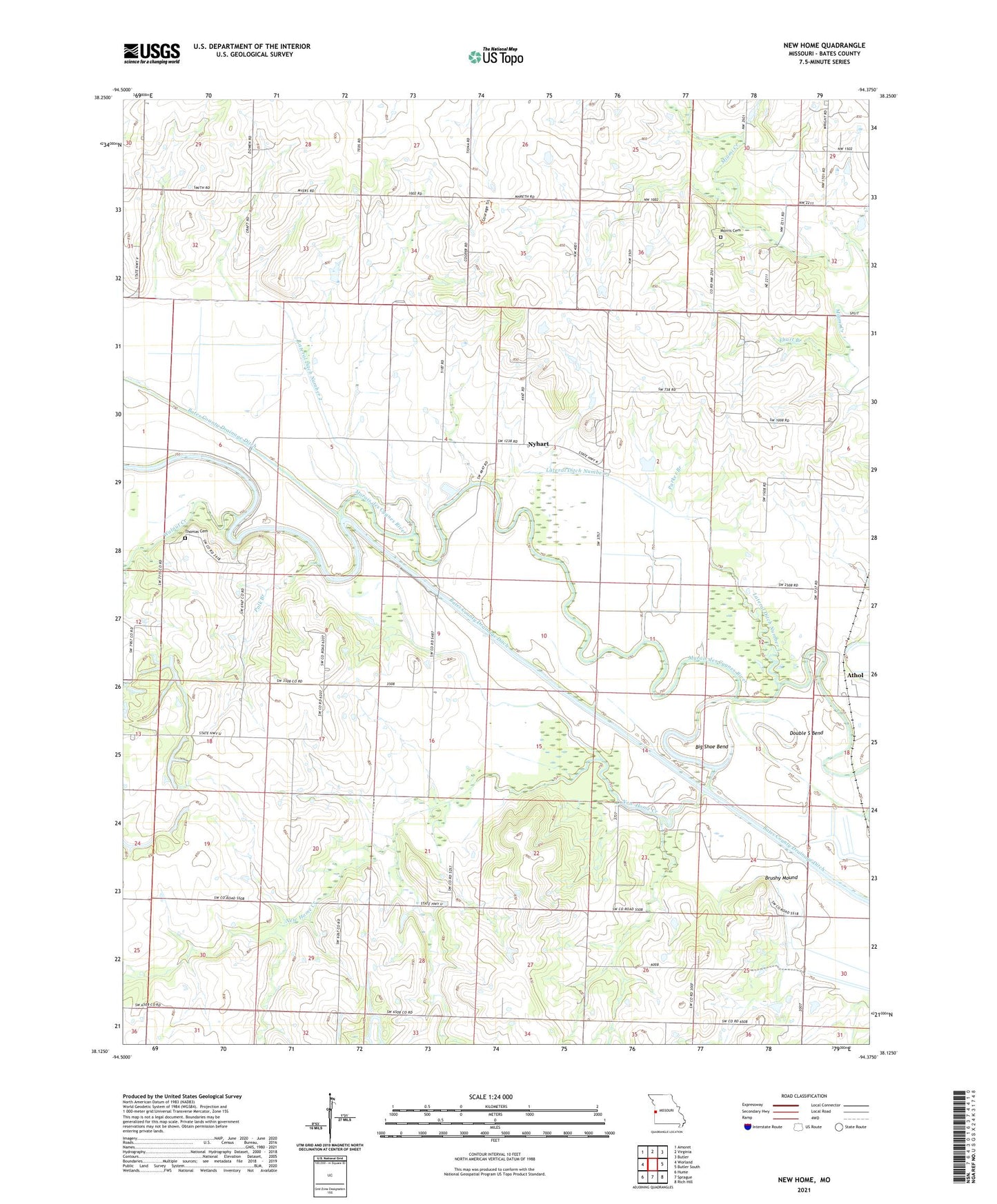
2021 topographic map quadrangle New Home in the state of Missouri. Scale: 1:24000. Based on the newly updated USGS 7.5' US Topo map series, this map is in the following counties: Bates. The map contains contour data, water features, and other items you are used to seeing on USGS maps, but also has updated roads and other features. This is the next generation of topographic maps. Printed on high-quality waterproof paper with UV fade-resistant inks.
Quads adjacent to this one:
West: Worland
Northwest: Amoret
North: Virginia
Northeast: Butler
East: Butler South
Southeast: Rich Hill
South: Sprague
Southwest: Hume
This map covers the same area as the classic USGS quad with code o38094b4.
Contains the following named places: Athol, Belmont School, Big Shoe Bend, Black Diamond Mine, Brushy Mound, Brushy Mound Lake, Cornland, Cornland School, Double S Bend, Ehart Branch, Enterprise School, Grandview School, Hillside School, Lateral Ditch Number 2, Lateral Ditch Number 3, Lateral Ditch Number Three, Long Lake, Lost Corner School, Morris Cemetery, New Home, New Home Creek, New Home School, New Hope Church, Nyhart, Nyhart School, Oerke Enterprises Airport, Parker Branch, Polk Branch, Reavley School, Thomas Cemetery, Township of New Home, Virginia School, Walnut Creek, ZIP Code: 64745