MyTopo
Adrian Missouri US Topo Map
Couldn't load pickup availability
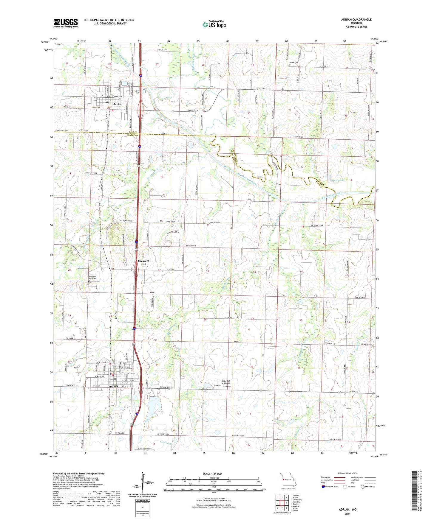
2021 topographic map quadrangle Adrian in the state of Missouri. Scale: 1:24000. Based on the newly updated USGS 7.5' US Topo map series, this map is in the following counties: Bates, Cass. The map contains contour data, water features, and other items you are used to seeing on USGS maps, but also has updated roads and other features. This is the next generation of topographic maps. Printed on high-quality waterproof paper with UV fade-resistant inks.
Quads adjacent to this one:
West: Main City
Northwest: Everett
North: Austin
Northeast: Garden City
East: Dayton
Southeast: Spruce
South: Butler
Southwest: Virginia
This map covers the same area as the classic USGS quad with code o38094d3.
Contains the following named places: Adrian, Adrian City Fire Department, Adrian Elementary School, Adrian Police Department, Adrian Post Office, Adrian Reservoir, Adrian Reservoir Dam, Adrian Rural Fire Department, Adrian Senior High School, Angle Bar M Airport, Archie, Archie Elementary School, Archie High School, Archie Police Department, Archie Post Office, Archie Wastewater Treatment Lagoon South Grand River, Austin Cemetery, Big Deer Creek, Central Cass County Fire Protection District Station 3, City of Adrian, City of Archie, Coleville, Coleville Community Hall, Coleville School, Crescent Hill, Crescent Hill Cemetery, Crescent Hill School, Eightmile Creek, Fairview School, Grinter Lake, Grinter Lake Dam, Hess School, High View School, Little Deer Creek, Martens Lake Dam, Mingo School, Mormon Fork, Side Stream Reservoir, Township of Deer Creek, Victory School, ZIP Codes: 64720, 64725