MyTopo
Butler South Missouri US Topo Map
Couldn't load pickup availability
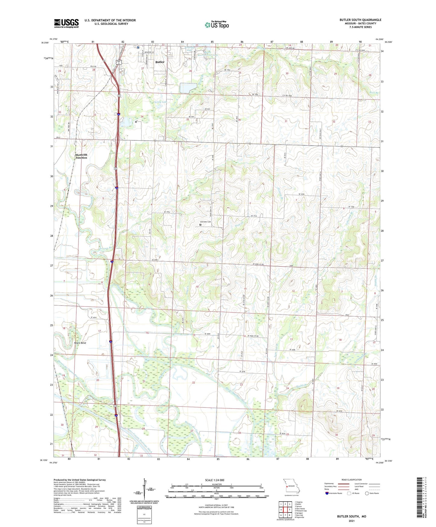
2021 topographic map quadrangle Butler South in the state of Missouri. Scale: 1:24000. Based on the newly updated USGS 7.5' US Topo map series, this map is in the following counties: Bates. The map contains contour data, water features, and other items you are used to seeing on USGS maps, but also has updated roads and other features. This is the next generation of topographic maps. Printed on high-quality waterproof paper with UV fade-resistant inks.
Quads adjacent to this one:
West: New Home
Northwest: Virginia
North: Butler
Northeast: Spruce
East: Pleasant Gap
Southeast: Papinville
South: Rich Hill
Southwest: Sprague
Contains the following named places: Bates County Drainage Ditch, Bates County Hospital Heliport, Bates County Memorial Hospital, Black School, Brackney School, Butler Recreational Lake, Byrd, Christy Lake, Church of the Nazarene, Double Branch Christian Church, Double Branch School, Fairview Cemetery, Feely, First Assembly of God Church, Happy Hill School, Kennedy Lake, KMAM-AM (Butler), KMoe-FM (Butler), Lone Oak Branch, Miami Creek, Miami Drainage Ditch, Miller School, Monteith Junction, Mound Branch, Mount Zion United Methodist Church, Negro Bend, Oak Grove School, Park Branch, Peru, Peru School, Pleasant Valley, Possum Branch, Root Branch, Saint Patricks Church, Soap Creek, South Double Branch, Star School, Township of Lone Oak, Tripp School