MyTopo
Sprague Missouri US Topo Map
Couldn't load pickup availability
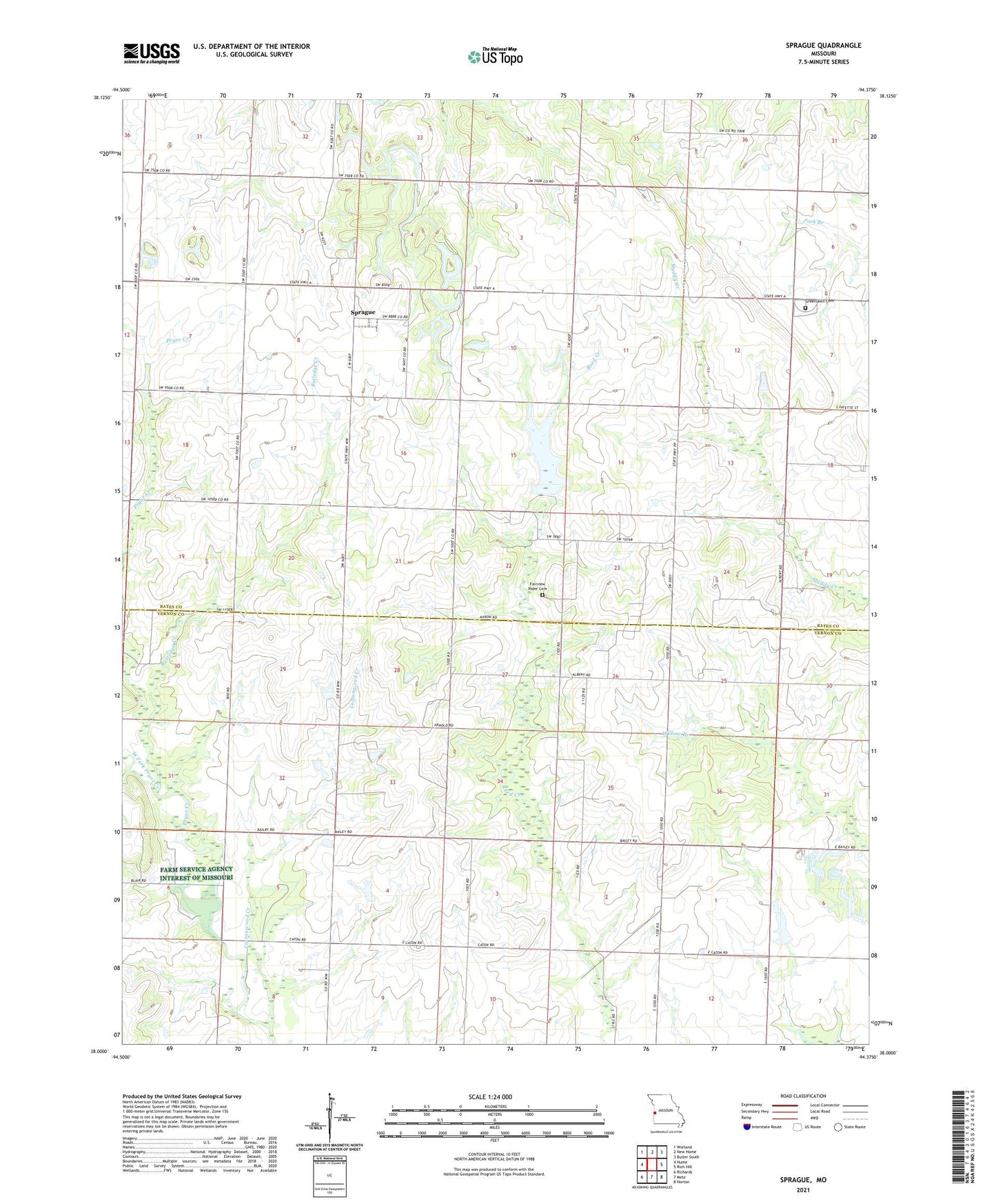
2021 topographic map quadrangle Sprague in the state of Missouri. Scale: 1:24000. Based on the newly updated USGS 7.5' US Topo map series, this map is in the following counties: Bates, Vernon. The map contains contour data, water features, and other items you are used to seeing on USGS maps, but also has updated roads and other features. This is the next generation of topographic maps. Printed on high-quality waterproof paper with UV fade-resistant inks.
Quads adjacent to this one:
West: Hume
Northwest: Worland
North: New Home
Northeast: Butler South
East: Rich Hill
Southeast: Horton
South: Metz
Southwest: Richards
This map covers the same area as the classic USGS quad with code o38094a4.
Contains the following named places: Bethel Church, Cottonwood Creek, Dell School, Fairview Rider Cemetery, Fairview School, Greenlawn Cemetery, Harmony Mission Wildlife Area, Keith, Keith School, Mongomery School, Mononame 64 Dam, Peabody Wildlife Area, Pohl-Harner Lake Dam, Rutledge Creek, Sartorius School, Sprague, Sprague School, West Fork Pryor Creek, White Rock School, ZIP Code: 64779