MyTopo
Chillicothe Missouri US Topo Map
Couldn't load pickup availability
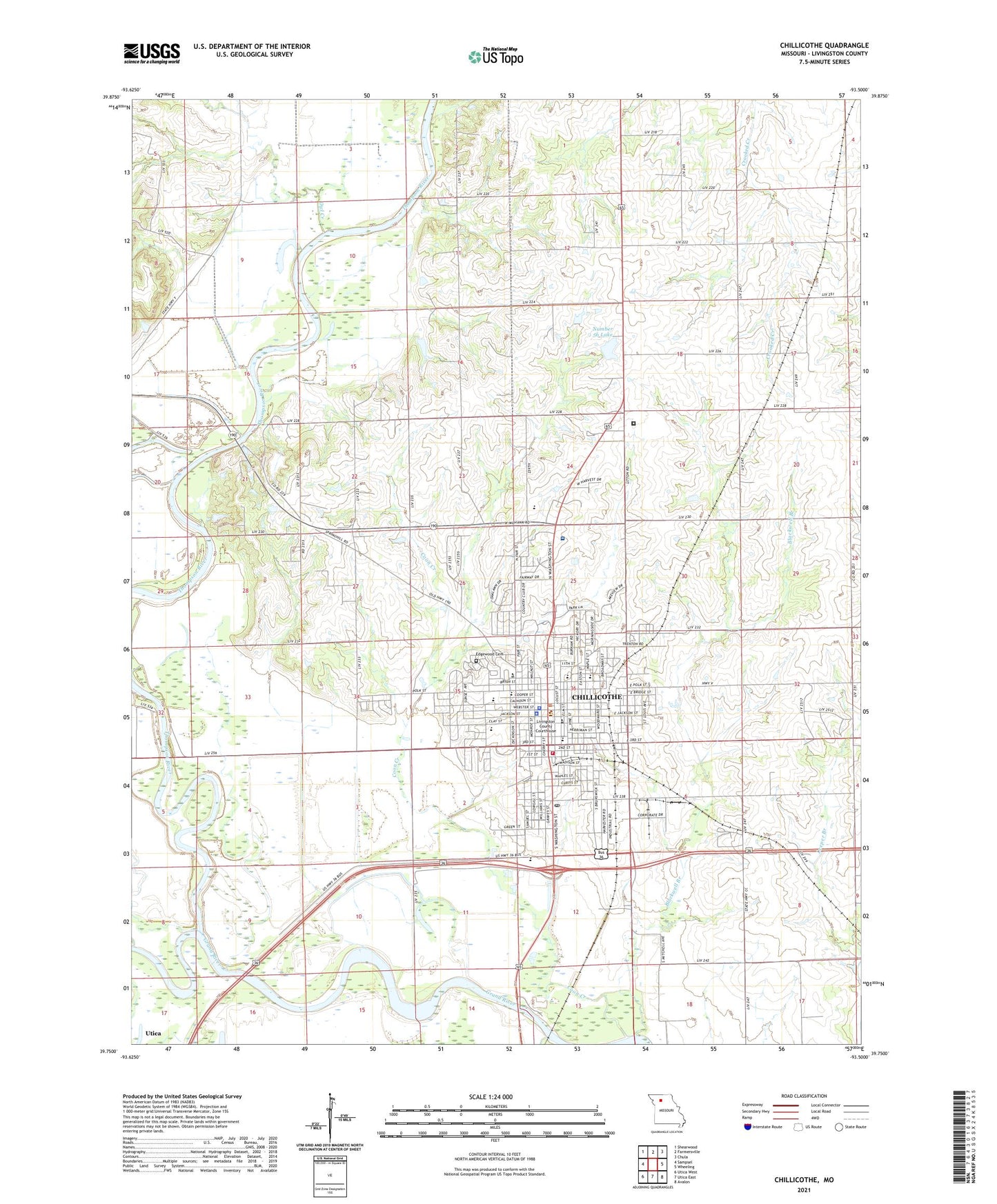
2021 topographic map quadrangle Chillicothe in the state of Missouri. Scale: 1:24000. Based on the newly updated USGS 7.5' US Topo map series, this map is in the following counties: Livingston. The map contains contour data, water features, and other items you are used to seeing on USGS maps, but also has updated roads and other features. This is the next generation of topographic maps. Printed on high-quality waterproof paper with UV fade-resistant inks.
Quads adjacent to this one:
West: Sampsel
Northwest: Shearwood
North: Farmersville
Northeast: Chula
East: Wheeling
Southeast: Avalon
South: Utica East
Southwest: Utica West
This map covers the same area as the classic USGS quad with code o39093g5.
Contains the following named places: Adams School, Bishop Hogan Memorial School, Bliss School, Carlton Lake Dam, Central School, Chillicothe, Chillicothe Alternative Center for Education, Chillicothe Correctional Center, Chillicothe Fire Department, Chillicothe High School, Chillicothe Middle School, Chillicothe Police Department, Chillicothe Post Office, City of Chillicothe, Coon Creek, Copeland Lake Dam, Dewey School, Edgewood Cemetery, Field Elementary School, Garrison School, Girdner School, Graham Mill Bridge, Grand River Technical School, Green Grove School, Hamilton Lake East Dam, Hamilton Lake West Dam, Hedrick Medical Center, Jones School, KCHI-AM (Chillicothe), KCHI-FM (Chillicothe), Lake Creek, Linville School, Litton Lake North Dam, Litton Lake South Dam, Livingston County, Livingston County Sheriff's Office, Minor School, Number 56 Lake, Oak Grove School, Olenhouse Lake Dam, Owl Creek, Smith Lake Dam, Thistlethwait Lake Dam, Thompson River, Township of Chillicothe, Verelle Peniston State School, Willard School, Woodland School, ZIP Code: 64601