MyTopo
Utica West Missouri US Topo Map
Couldn't load pickup availability
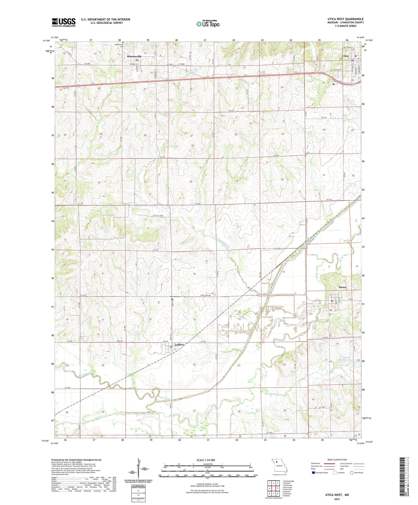
2021 topographic map quadrangle Utica West in the state of Missouri. Scale: 1:24000. Based on the newly updated USGS 7.5' US Topo map series, this map is in the following counties: Livingston. The map contains contour data, water features, and other items you are used to seeing on USGS maps, but also has updated roads and other features. This is the next generation of topographic maps. Printed on high-quality waterproof paper with UV fade-resistant inks.
Quads adjacent to this one:
West: Flat Creek
Northwest: Breckenridge
North: Sampsel
Northeast: Chillicothe
East: Utica East
Southeast: Coloma
South: Plymouth
Southwest: Braymer
This map covers the same area as the classic USGS quad with code o39093f6.
Contains the following named places: Bethel Church, Brush College School, Bryanville School, Clear Creek, Dawn, Dawn Census Designated Place, Dawn Fire Protection Association, Dawn Post Office, Dawn Station, Gilliland Lake Dam North, Gilliland Lake Dam South, Green Township Fire Protection District 4066, Johnson Lake Dam, Johnson School, Jones Lake Dam, Ludlow, Ludlow Post Office, Maple Grove School, Mc Corskie Church, Melvin Watkins Lake, Monroe Cemetery, Mooresville, Mooresville Cemetery, Mooresville Township Fire Protection District, Mud Creek, Mud Creek Drainage Ditch, Oak Grove School, Paul Jones Lake Dam, Perry Ridge School, Rattlesnake Creek, Risley School, Shoal Creek Drainage Ditch, Southwest Elementary School, Southwest High School, Stone School, Tonerville School, Town of Ludlow, Township of Monroe, Township of Mooresville, Utica, Utica Cemetery, Utica Post Office, Village of Mooresville, Village of Utica, Warner School, Water Tank, Watkin Lake Dam, ZIP Codes: 64656, 64664