MyTopo
Brumley Missouri US Topo Map
Couldn't load pickup availability
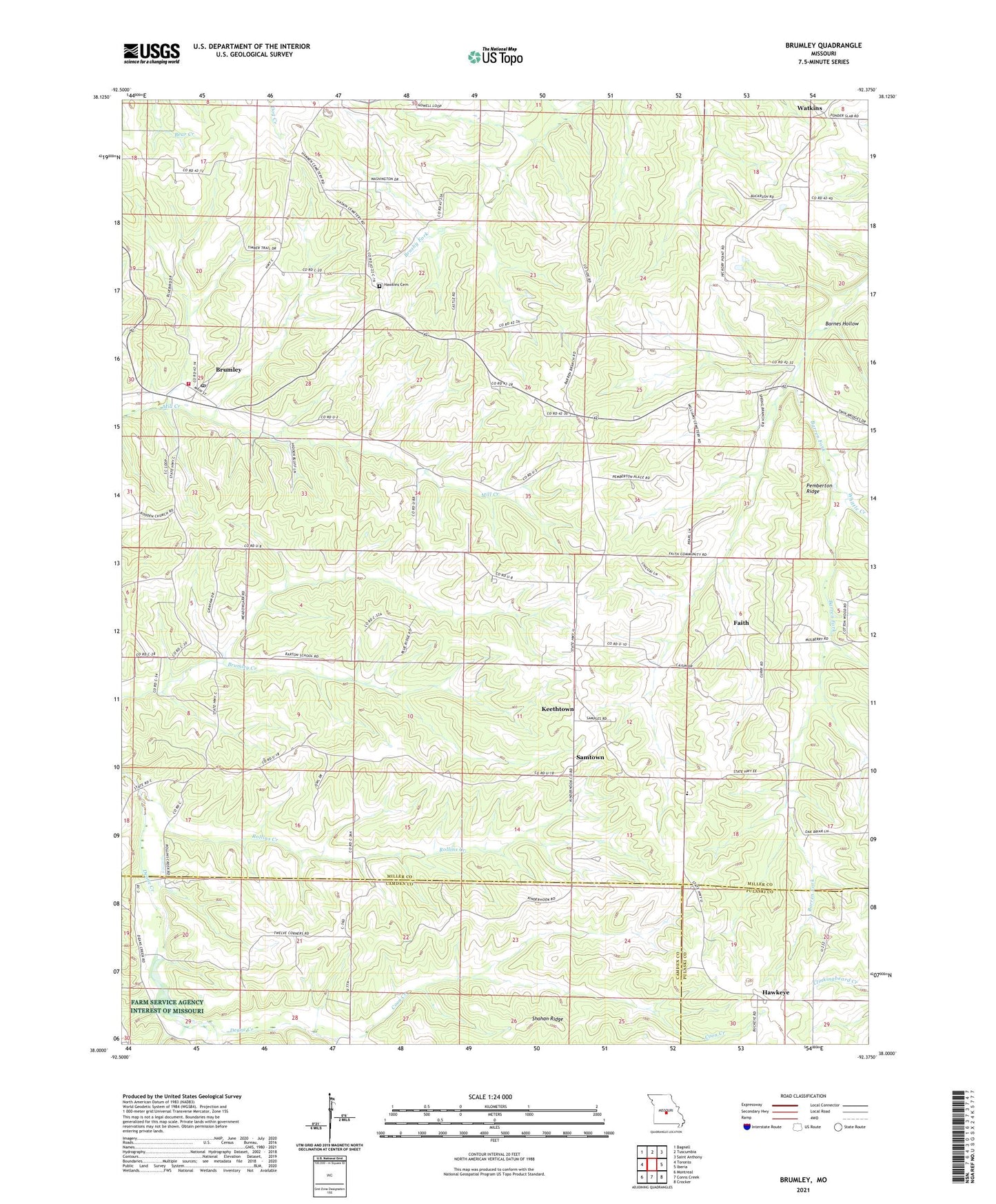
2021 topographic map quadrangle Brumley in the state of Missouri. Scale: 1:24000. Based on the newly updated USGS 7.5' US Topo map series, this map is in the following counties: Miller, Camden, Pulaski. The map contains contour data, water features, and other items you are used to seeing on USGS maps, but also has updated roads and other features. This is the next generation of topographic maps. Printed on high-quality waterproof paper with UV fade-resistant inks.
Quads adjacent to this one:
West: Toronto
Northwest: Bagnell
North: Tuscumbia
Northeast: Saint Anthony
East: Iberia
Southeast: Crocker
South: Conns Creek
Southwest: Montreal
This map covers the same area as the classic USGS quad with code o38092a4.
Contains the following named places: Barnes Hollow, Barton School, Brumley, Brumley Fire Protection District, Brumley Post Office, Coon Creek, Curry Chapel, Curry School, Faith, George School, Glover Chapel, Gott Church, Gott School, Hawkeye, Hawkins Cemetery, Hickory Point Baptist Church, Hickory Point Christian Church, Honey Spring School, Keethtown, Mount Union Church, Pemberton Ridge, Rollins Creek, Ross School, Samtown, Shahan Ridge, Skin Heel School, Town of Brumley, Twelve Corners Church, Watkins, Whittle Creek, ZIP Code: 65017