MyTopo
Caruthersville SE Tennessee US Topo Map
Couldn't load pickup availability
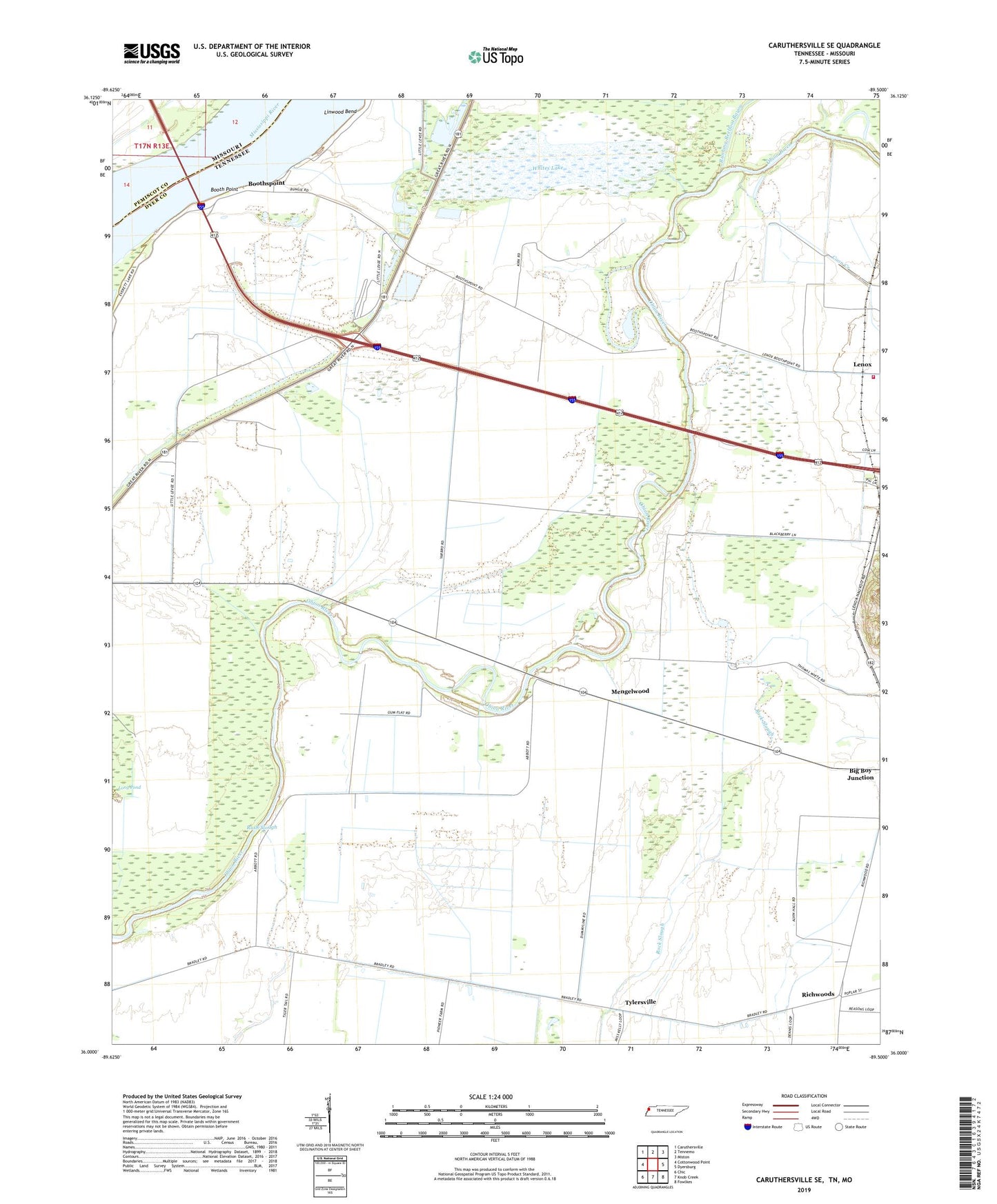
2022 topographic map quadrangle Caruthersville SE in the states of Tennessee, Missouri. Scale: 1:24000. Based on the newly updated USGS 7.5' US Topo map series, this map is in the following counties: Dyer, Pemiscot. The map contains contour data, water features, and other items you are used to seeing on USGS maps, but also has updated roads and other features. This is the next generation of topographic maps. Printed on high-quality waterproof paper with UV fade-resistant inks.
Quads adjacent to this one:
West: Cottonwood Point
Northwest: Caruthersville
North: Tennemo
Northeast: Miston
East: Dyersburg
Southeast: Fowlkes
South: Knob Creek
Southwest: Chic
This map covers the same area as the classic USGS quad with code o36089a5.
Contains the following named places: Booth Point, Booth Point Dikes, Booth Point Landing, Boothspoint, Commissioner District 5, Coon Creek, District 14, District 19, Emanuel Church, Gum Flat School, Holiness Church, Island Number 17, Lenox Volunteer Fire Department, Linwood Bend, Linwood Bend Revetment, Mengelwood, Mississippi-Obion Division, Pleasant Valley Church, Richwoods, Rock Slough, Running Reelfoot Bayou, Rush Slough, Rush Slough School, Tylersville, Whites Lake, ZIP Codes: 38030, 38047