MyTopo
Knob Creek Tennessee US Topo Map
Couldn't load pickup availability
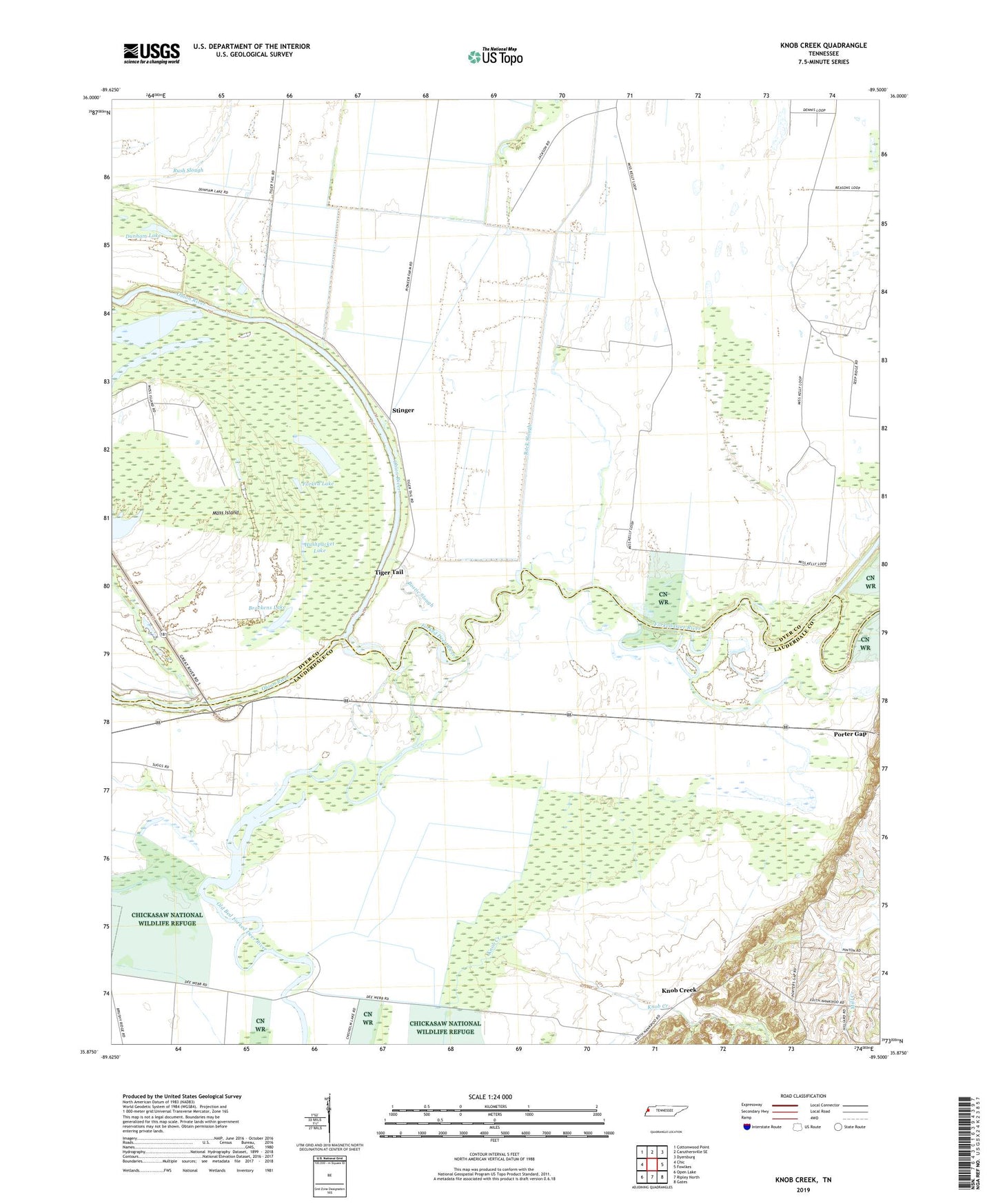
2022 topographic map quadrangle Knob Creek in the state of Tennessee. Scale: 1:24000. Based on the newly updated USGS 7.5' US Topo map series, this map is in the following counties: Dyer, Lauderdale. The map contains contour data, water features, and other items you are used to seeing on USGS maps, but also has updated roads and other features. This is the next generation of topographic maps. Printed on high-quality waterproof paper with UV fade-resistant inks.
Quads adjacent to this one:
West: Chic
Northwest: Cottonwood Point
North: Caruthersville SE
Northeast: Dyersburg
East: Fowlkes
Southeast: Gates
South: Ripley North
Southwest: Open Lake
This map covers the same area as the classic USGS quad with code o35089h5.
Contains the following named places: Bostic Slough, Brackens Lake, Crest Ridge School, Dunham Lake, Forked Deer River, Forked Lake, Hales Point School, Helm Church, Henning Grove Church, Henning Grove School, Hickory Landing, Hushpucket Lake, Knob Creek, Lake Wood, Moss Island, Moss Island State Wildlife Management Area, Papaw Ridge, Papaw Ridge Church, Rhodes Lake, Rock Slough, Stinger, Tiger Tail